Hello!
When I get the Sentinel-2 images from EO browser for my AOI, the resolution is not 10m but slightly different.
It means that data are reprojected with from original UTM tiles and some processing is applied.
How can I get a true ‘extract’ from the original images in UTM coordinates?
E.g. force my AOI to be rounded to 10m grid of UTM so that no reprojection is performed.
Will uploading a bounding box with rounded coordinates do the trick?
Thanks
Hi,
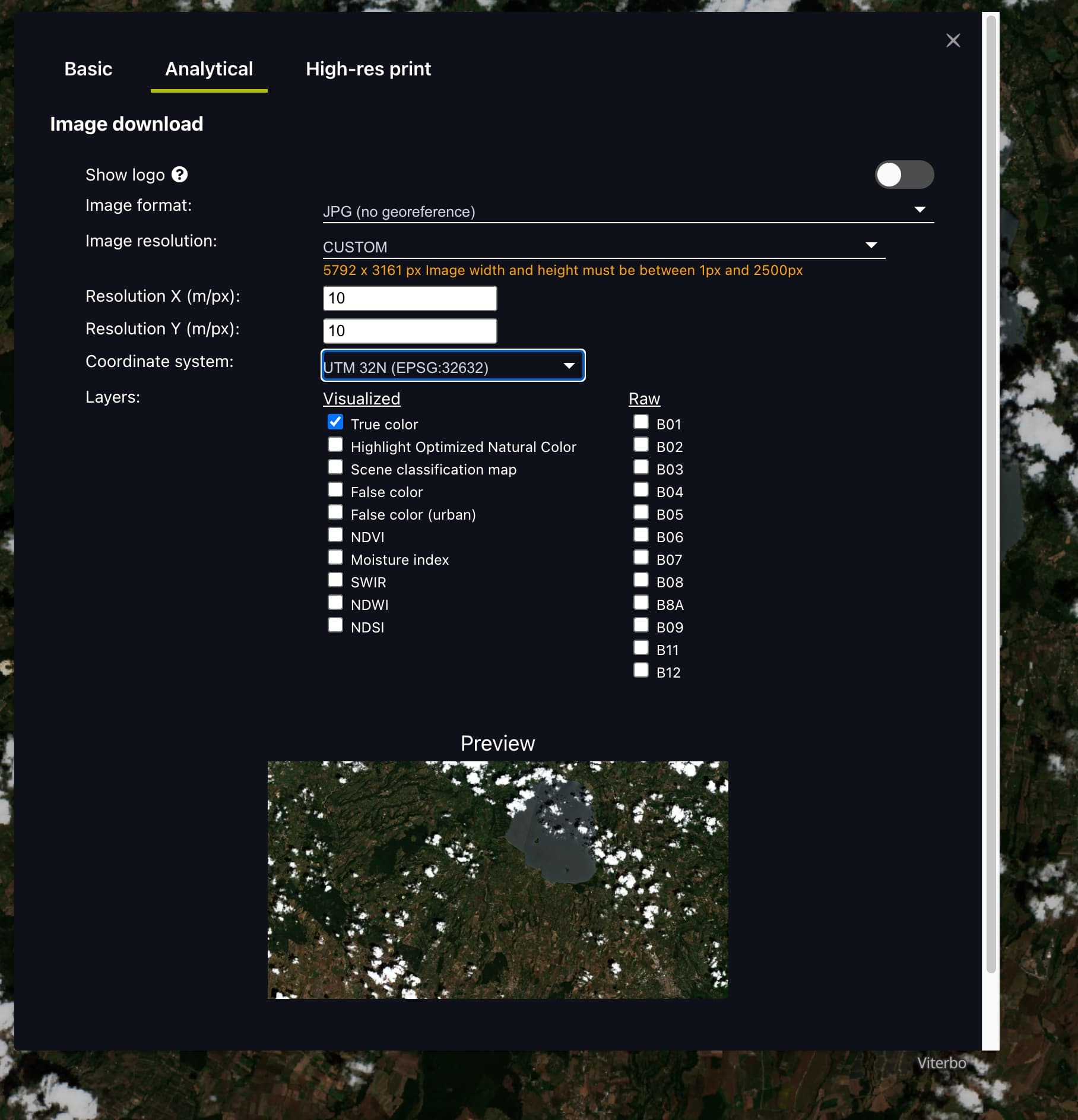
Yes you can explicitly set the the resolution to 10m resolution using the Analytical data extraction tools. When selecting Resolution, you can select CUSTOM and then insert the resolution that you require. You can also set the Coordinate system as the UTM zone that your AOI is located in too. Be aware that your exported image can’t exceed 2500 pixels on either axis.
Hi,,
thank you for the response.
Yes, I can get resolution close to 10m in this case, but not precisely 10.
And the data is not a pure subset of the selected tile which is what I want.
Hi,
To get the exact original reflectance values, you must make sure that the pixels outputted by Sentinel Hub are at exactly the same position and exactly the same size as in the original data.
To do this your bounding box must be aligned with the grid in which satellite data is distributed. For more information I recommend reading this FAQ and this.
Many thanks, clear to me now!
Reply
Enter your E-mail address. We'll send you an e-mail with instructions to reset your password.


