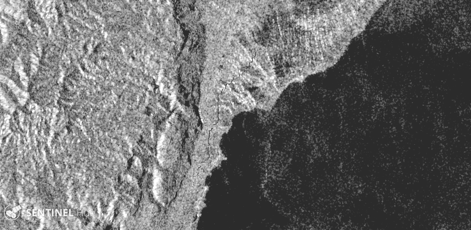
There’s a strange linear artifact in the orthorectifed S1 images in the EO Browser, which looks like a pixellated edge of something.
Is it caused by the orthorectification? If so, what feature is it, an outdated water surface edge?

There’s a strange linear artifact in the orthorectifed S1 images in the EO Browser, which looks like a pixellated edge of something.
Is it caused by the orthorectification? If so, what feature is it, an outdated water surface edge?
Hm, I am not sure if I see what you see  as I do not notice anything specifically strange.
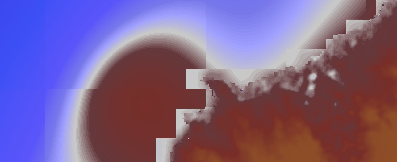
In case the issue is only with orthorectification, the likely culprit is digital elevation model, which is far from perfect. You should be able to notice similar patterns in it, e.g. here:
DEM imagery taken on October 18, 2020
Yes, as I suspected it is the DEM which is at fault.
Which DEM product is it? it has many problems
https://registry.opendata.aws/terrain-tiles/
it is not best indeed, although in parts much better than SRTM30. Once we find some other one available on the cloud infrastructure, we will consider switching. Or perhaps make it an option.
Enter your E-mail address. We'll send you an e-mail with instructions to reset your password.
© 2024 Planet Labs PBC. All rights reserved.
|
Privacy Policy | California Privacy Notice |
California Do Not Sell
Your Privacy Choices
| Cookie Notice | Terms of Use
