Hi,
Thanks for the quick response.
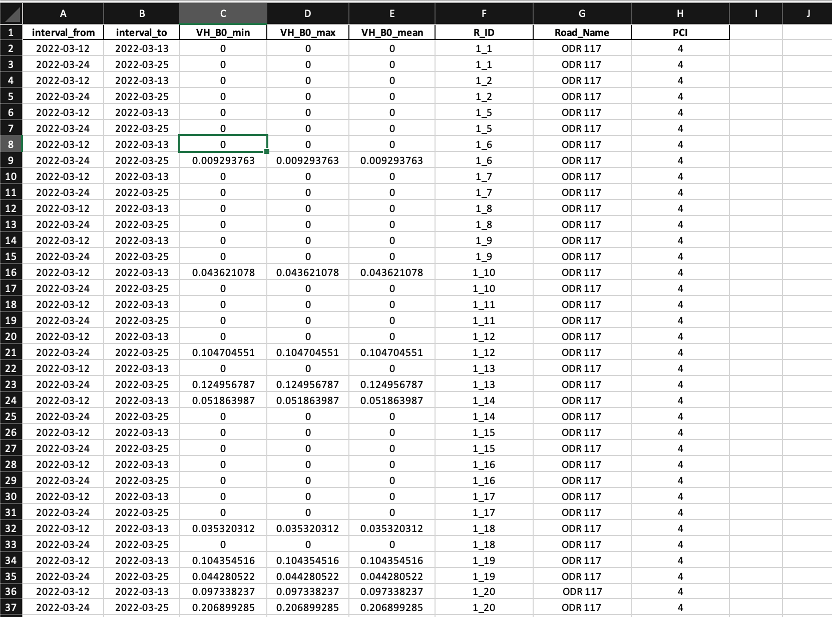
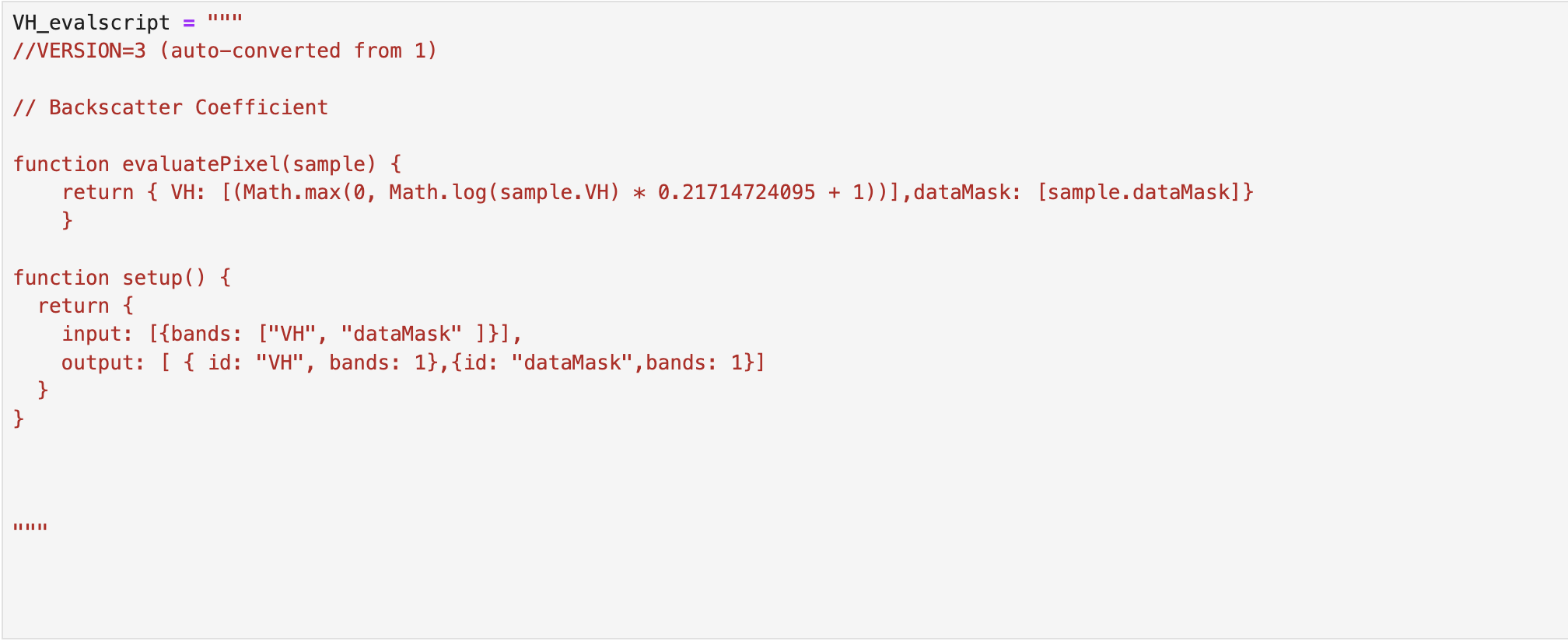
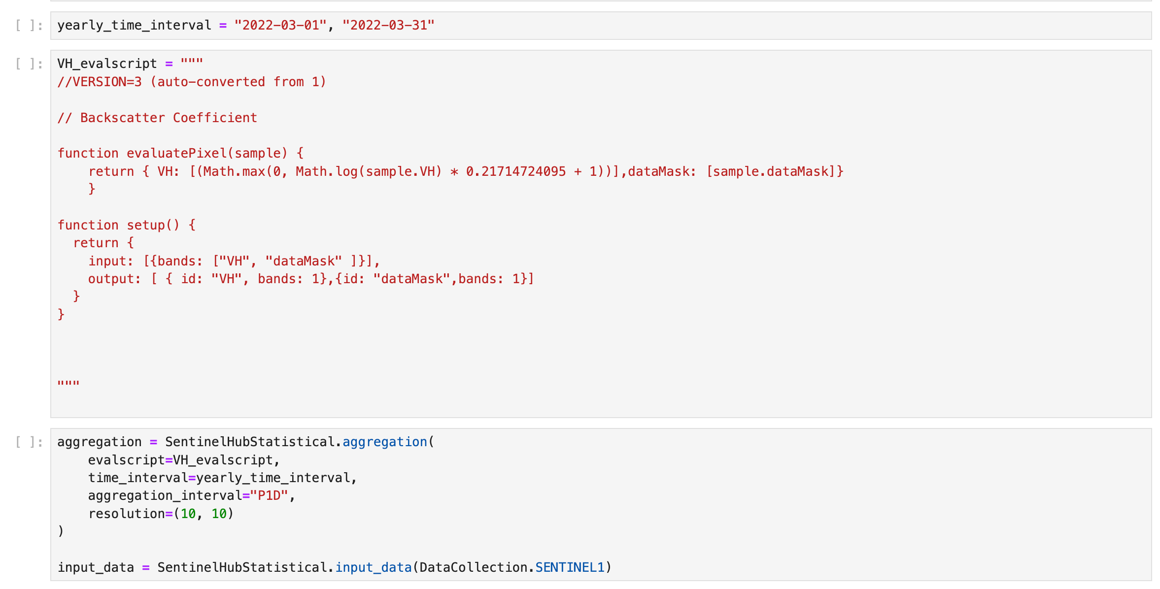
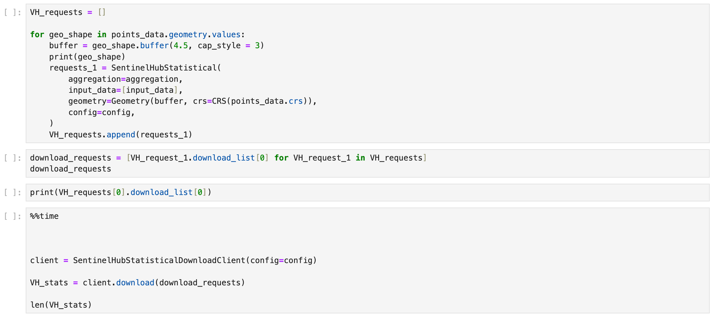
Here the screenshot for full request and Area of interest as a shape file.
I am not able to upload the shape file, can you suggest an alternative to share the AOI file
If you can share the geojson string of the area of interest, this is sufficient.
In addition, you are aware that the revisit time of Sentinel-1 was at best 5 days (pre Sentinel-1B failure in 2022)? Since then revisit times are not as good, and parts of the world are not covered at all. You can read more into this in the documentation here.
Hi,
Please have a look at the geojson content here. Looking forward to your response. Understanding these zero values are very crucial now.
{
"type": "FeatureCollection",
"name": "ODR_117_patch_1km_geojson",
"crs": {
"type": "name",
"properties": {
"name": "urn:ogc:def:crs:EPSG::32643"
}
},
"features": [
{
"type": "Feature",
"properties": {
"fid_1": 1.0,
"Id": 29824.0,
"Segment Id": "13560022995077",
"NewSegId": "00004e31-3600-0400-0000-000002b18269",
"Length": 467.86212991836157,
"FRC": 4.0,
"SpeedLimit": 55.0,
"StreetName": null,
"Road_name": "ODR 117\r",
"From": 7.0,
"To": 7.25,
"From_lat": 19.443221,
"From_long": 73.14024397,
"Carriagewa": 3.7,
"PCI": 4
},
"geometry": {
"type": "MultiLineString",
"coordinates": [
[
[
304706.83957613183884,
2150692.730525482445955
],
[
304713.142366190091707,
2150696.36675051599741
],
[
304717.263421228155494,
2150705.093690596520901
],
[
304721.869306270731613,
2150722.305155755486339
],
[
304727.687266324472148,
2150745.819410972762853
],
[
304733.262811375956517,
2150772.727476221974939
],
[
304741.020091447629966,
2150807.392821542453021
],
[
304744.40703947172733,
2150824.540239416994154
],
[
304749.980695497361012,
2150854.372172050643712
],
[
304754.474124071886763,
2150874.299362160731107
],
[
304760.534499127883464,
2150900.237767400220037
],
[
304763.322271653625648,
2150921.449080096557736
],
[
304766.110044179426041,
2150944.720920311752707
],
[
304767.928156696201768,
2150958.659782940521836
],
[
304769.746269213035703,
2150979.628680634312332
],
[
304771.928004233166575,
2150995.870485784485936
],
[
304775.564229266776238,
2151010.415385918691754
],
[
304777.74596428690711,
2151022.778551033232361
],
[
304779.806491805939004,
2151032.353943621274084
],
[
304783.321509338391479,
2151049.322993778157979
],
[
304789.260676893347409,
2151073.140267747920007
],
[
304792.775694425858092,
2151087.685167882591486
],
[
304799.563314488448668,
2151109.684329335577786
],
[
304805.138859539991245,
2151127.623039501253515
],
[
304809.744744582509156,
2151141.683109631296247
]
]
]
}
},
{
"type": "Feature",
"properties": {
"fid_1": 2.0,
"Id": 29824.0,
"Segment Id": "13560022995077",
"NewSegId": "00004e31-3600-0400-0000-000002b18269",
"Length": 467.86212991813562,
"FRC": 4.0,
"SpeedLimit": 55.0,
"StreetName": null,
"Road_name": "ODR 117\r\n",
"From": 6.5,
"To": 7.0,
"From_lat": 19.44734597,
"From_long": 73.141418,
"Carriagewa": 3.7,
"PCI": 5
},
"geometry": {
"type": "MultiLineString",
"coordinates": [
[
[
304809.744744582509156,
2151141.683109631296247
],
[
304813.502177117217798,
2151150.288842210546136
],
[
304818.956514667661395,
2151161.92476231791079
],
[
304826.228964734822512,
2151181.196754996199161
],
[
304834.955904815462418,
2151201.317200182005763
],
[
304841.501109876029659,
2151221.195230366196483
],
[
304844.894919907383155,
2151237.921865520533174
],
[
304849.137182446545921,
2151255.496953182853758
],
[
304854.106689992477186,
2151275.132568364031613
],
[
304860.045857547374908,
2151298.16199357714504
],
[
304863.19725257641403,
2151310.525158690754324
],
[
304866.833477610023692,
2151327.736623849719763
],
[
304871.318155151442625,
2151341.069448973052204
],
[
304877.984567713108845,
2151364.704911691602319
],
[
304884.166150270262733,
2151378.03773681493476
],
[
304889.135657816193998,
2151393.673504458740354
],
[
304893.74154285871191,
2151409.915309608913958
],
[
304900.650370422576088,
2151427.005567267071456
],
[
304909.498518004314974,
2151451.610689993947744
],
[
304923.679795635398477,
2151489.669845345430076
],
[
304938.467110772035085,
2151515.729458086192608
],
[
304949.193974621186499,
2151534.395413258578628
],
[
304959.860234719817527,
2151556.576385963708162
],
[
304967.253892288077623,
2151572.878794864285737
],
[
304969.799249811563641,
2151581.72694244608283
]
]
]
}
}
]
}
Hi,
For the polygons that you have supplied, there are indeed only two acquisitions in the time period that you requested. I have checked this in Catalog API. The only issue I can see where you might also be missing data is:
- Some of your road segments are outside the image footprint of the Sentinel-1 acquisition.
- Your road buffer may need to be widened. Your buffer is 9m in width, whilst your image resolution is 10x10m, and this may result in unexpected behaviour as the AOI used for the calculation is narrower than the resolution of the imagery you are using for the calculation.


