Hi everyone
Please advise me how to get a clear image when browsing or monitoring Earth instead of the blurry image.
Sorry for i am a new user.
Thank you

Page 1 / 1
Hello,
The freely available satellite data served by Sentinel Hub are designed to monitor large-scale activities/processes on the Earth’s surface such as agriculture, biodiversity changes, climate and many more… (see more details here for example). The satellites used for these purposes have a maximum resolution of 10 m (Sentinel-2), which may lead to thinking that they are “blurry” compared to aerial or high-resolution images that you are used to with popular navigation/mapping apps.
If you need higher resolution imagery, we currently offer data from the following commercial data providers. However, these come at an extra cost:
• Planet PlanetScope (4 bands, 3 m resolution)
• Planet Skysat(4 bands, 0.5m resolution)
• Airbus Pleiades (5 bands, 0.5 m – 2 m resolution)
• Airbus SPOT (5 bands, 1.5 m – 6 m resolution
• Maxar WorldView (5 bands, 0.5 m – 2 m resolution)
See the webinar on this topic here.
Thank you so much.
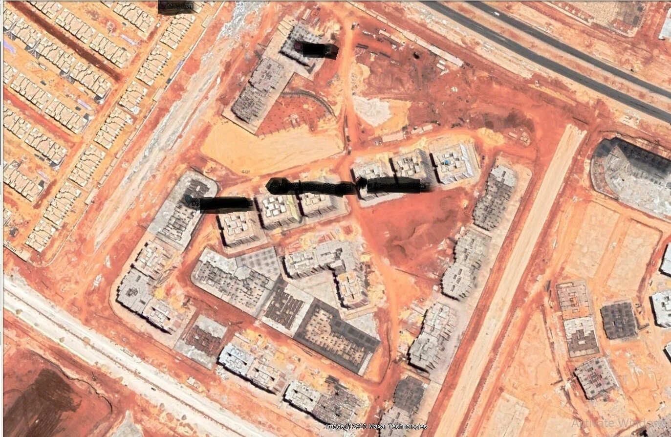
Is there a possibility to have a bit clear image as the following sample? Noting that I already have a paid account ’ Exploration Account’.

Note: My ‘Exploration Account’ is for both ‘EO Browser’ and ‘Sentinel Hub’
Reply
Enter your E-mail address. We'll send you an e-mail with instructions to reset your password.
© 2024 Planet Labs PBC. All rights reserved.
|
Privacy Policy | California Privacy Notice |
California Do Not Sell
Your Privacy Choices
| Cookie Notice | Terms of Use
