When sharing web adresses, the EO browser opens the start-page instead of the one with selected date, layer and so on. Can I somehow share an exact copy of my selections in the EO browser?
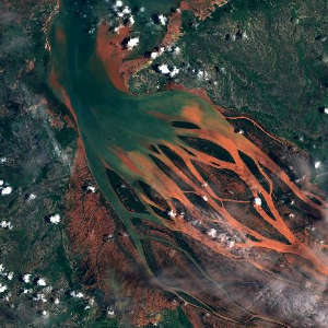
What exactly do you mean by “sharing”? If you copy the URL from the browser and send it to someone, it should work. For example this URL should show Mauritius on 2018-10-01, S-2 L1C, NDWI layer:

Sentinel-hub EO-Browser3
Sentinel-2 L2A imagery taken on August 18, 2018
Note that it take EO Browser a second or two to update URL after the selection is made.
Let us know if we are missing something.
Maby its because I include instance ID and a layer that is connected to that ID? Your link works fine
EO Browser should modify the URL (in the location bar in browser) automatically, you just need to copy it. Or does this not happen for you?
Yes, this does happen but since the adress points to a custom defined layer and the recieving user is not logged in, the adress does not work (it opens the start view, where you get to choose date and satellite, but with the correct location showing on the map). I wonder if it should be possible to point to a custom layer using the instance-id in the adress?
I see - indeed, this is something that doesn’t work, and we should fix it to enable easy sharing of links to private instances. At the moment I can’t give you an estimate when this will be fixed however.
There is a solution which is much more powerful, but has not been documented yet. It is a bit more involved though… I can outline it here, and we will document it soon. I am not sure if it is an overkill for your use case though - let me know if it helps.
What you can do is use a system for creating an “educational” version of EO Browser, which will present users with a modified version of EO Browser, showing just your selections.
Outline of the process is:
- create a
themes.jsonfile - upload it somewhere where it is accessible (and where CORS settings are permissive) - for example to GitHub
- create an EO Browser URL which points to this file and send it to user
The user will then get a “customized” EO Browser which will only display the datasets you have included. You can also (optionally) specify pins, in which case user will not be able to see and set his own pins, but will instead only be able to view your pins.
More in detail:
themes.json file must be a valid JSON. An example is: https://raw.githubusercontent.com/sentinel-hub/education/master/wildfires/themes.json
Note that you should specify your instances incontentand (optionally) addpins.
The easiest way to upload this file is to push it to a GitHub repository. For example the file I linked to is available at https://github.com/sentinel-hub/education/blob/master/wildfires/themes.json. To get the direct address to the file, you should click on “Raw” and copy the URL.
To construct the link which will use your newly created theme, you need to add it to EO Browser URL: https://apps.sentinel-hub.com/eo-browser/?lat=32.7342&lng=-17.0443&zoom=12&themesUrl=https://raw.githubusercontent.com/sentinel-hub/education/master/wildfires/themes.json&time=2016-08-07&preset=NORMALIZED-BURN-RATIO&datasource=Sentinel-2%20L1C%20-%20wildfires
Note thethemesUrlparameter - this is where the URL tothemes.jsonfile from point 2) should go.
You can see how this is used on our education page - see the example links to Madeira on Wildfires.
I realise that this process is very involved and might be an overkill for what you are trying to achieve, it is however the only solution I can think of at the moment. Let me know if it helps, or if you need additional instructions.
Thank you for your reply. The method you describe is probably overkill at the moment but might be useful for other tasks.
Right now I would like to be able to create a clickable link, opening eo browser with a custom layer (agriculture) over the choses extent (coordinates and zoom). Preferably this would be done using our istance id in the url, but I understand that is not possible.
Second best option is to define a custom layer, same as agriculture insert the coordinates and zoom and use that adress instead. We will then be able to do time-analysis but have to log in to do statistical analyses?
Yes, approach with the custom layer would work too.
We will then be able to do time-analysis but have to log in to do statistical analyses?
Yes, but users need to be logged in for time analysis too (I assume you mean preparing “timelapses” - animated GIFs with a time sequence?). If you mean just checking maps on different dates then login is not required.
Reply
Enter your E-mail address. We'll send you an e-mail with instructions to reset your password.

