
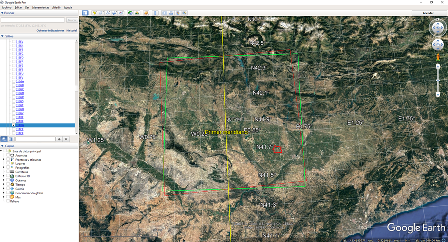
Hi all, I’m carrying out a precision agriculture assessment in Lleida (Catalonia) and I’ve some doubts. When I get NDVI values based on a user-defined polygon (irrigation district) I obtained, for the same date, two different products and results. The difference between these two images is referred to their UTM ZONE description (30TYM and 31TBG). They practically cover the same area but the NDVI values slightly differ. The differences are not statistically significant but, which will be the “correct” Sentinel tile?
Thank you so much for your collaboration,
