Hi,
Thanks for your enthusiasm and willingness to contribute. Unfortunately at this moment we don’t have an automated way to do so. If you have a list of water bodies you’d like to see added, please send us a geojson/geopackage/shapefile of nominal waterbody extents (vectors of waterbodies) with following attributes:
- country of the waterbody
- name of the waterbody
If the file would be read with geopandas, the resulting geodataframe should look like this:
| | country | name | geometry |
|---|
| 0 | Indonesia | Waduk Saguling | MULTIPOLYGON (((107.39950 -6.96325, 107.39971 … |
| 1 | Indonesia | Karangkates | POLYGON ((112.44627 -8.16392, 112.44650 -8.163… |
| 2 | Indonesia | Waduk Wadaslintang | POLYGON ((109.75293 -7.56967, 109.75305 -7.569… |
| 3 | Indonesia | Togo Ngebe | POLYGON ((111.62672 -7.79523, 111.62706 -7.793… |
| 4 | Indonesia | Cirata | POLYGON ((107.24025 -6.71600, 107.24114 -6.714… |
| … | … | … | … |
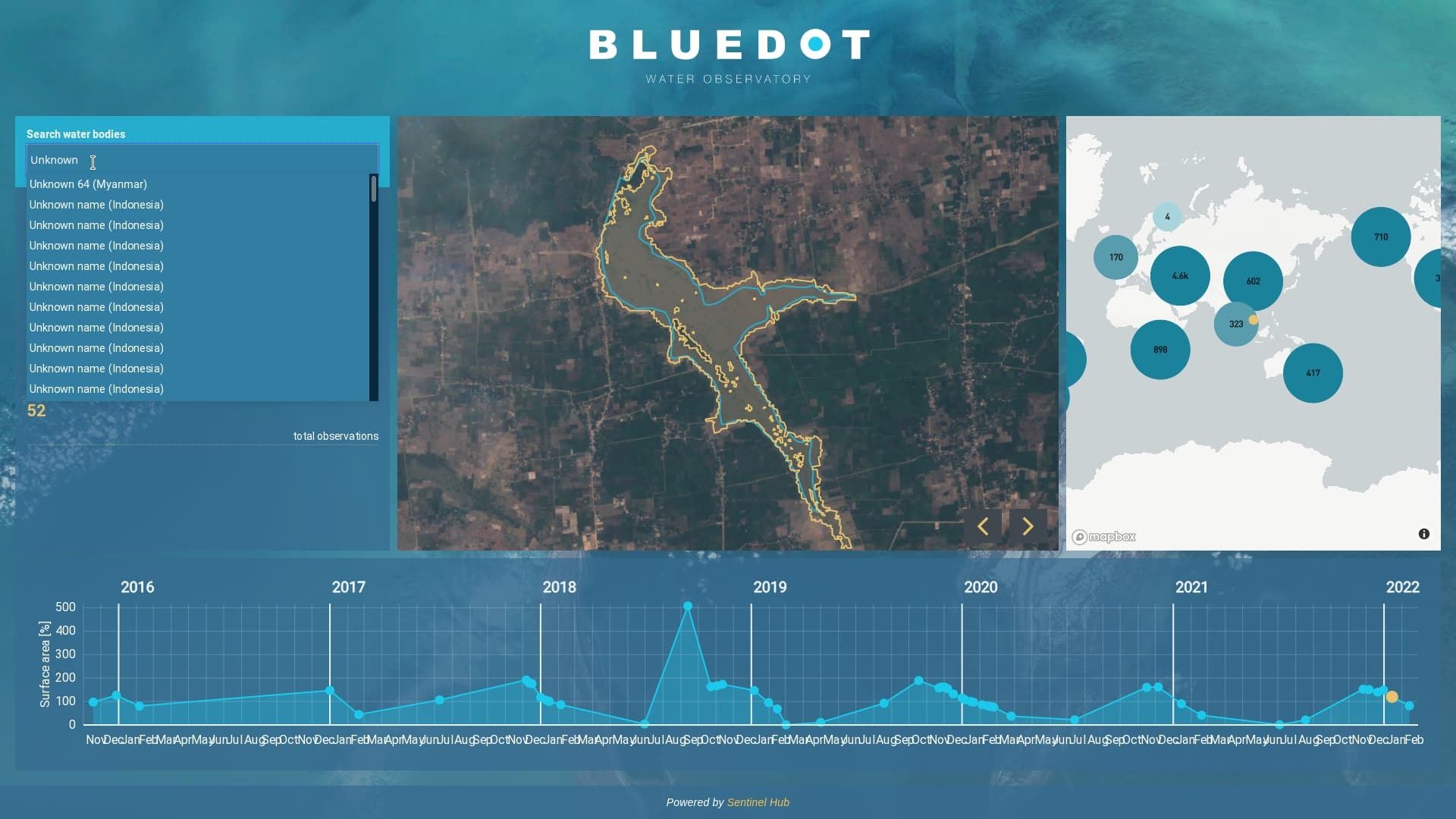
Sure, Most of ones I would like to name are already in the database. We just need to add names to those already listed as ‘Unknown …’
Great. A map like
{ waterbody_url: "correct name" }
would probably suffice. waterbody_url example: https://water.blue-dot-observatory.com/43