I am looking to process farm harvesting for small scale farmers with multiple plots. We are considering to move from Sentinal-2 to Planetscope daily dove images. Any suggestion on migrating the Barren Soil index from Sentinel-2 to the Panetscope sats? I see the wave length don’t exactly match up.
Hi,
PlanetScope does not have SWIR band (not even Planet’s 8-band super-doves) so it is not trivial to “port” the index directly.
We have trained a machine learning model to recognise bare soil as part of our Area monitoring services (read more about it here) and if you are interested, we are happy to offer you these services (as a managed service.
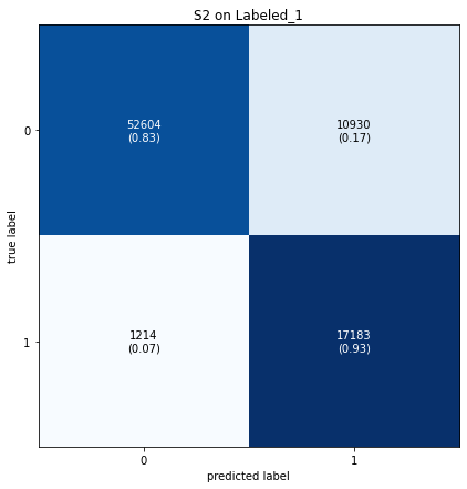
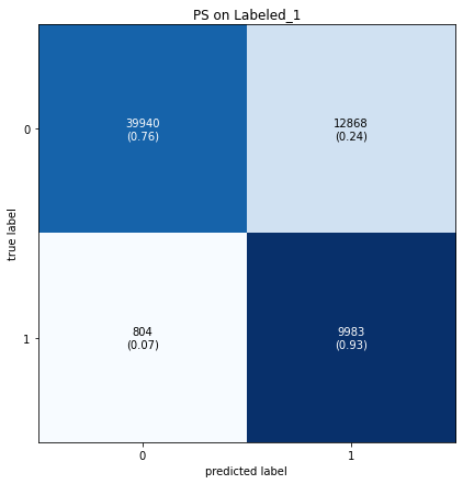
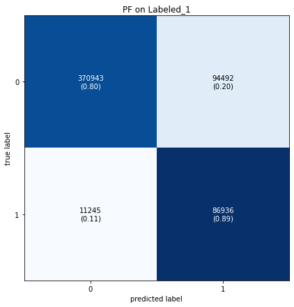
In case of interest - the model does not perform as well as with Sentinel-2 (there is value in these additional spectral bands!) but it is still usable. See comparison of confusion metrices for S2, PlanetScope and Planet Fusion, the latter one performing a bit better than PS.


If it’s not trivial to port, what are the recommendation that we can use for PS to view plots that have been just harvested on a day to day basis? I know I can test if % of pixel in the object drops sharply toward non-vegetation, but would there be a better way?
Reply
Enter your E-mail address. We'll send you an e-mail with instructions to reset your password.

