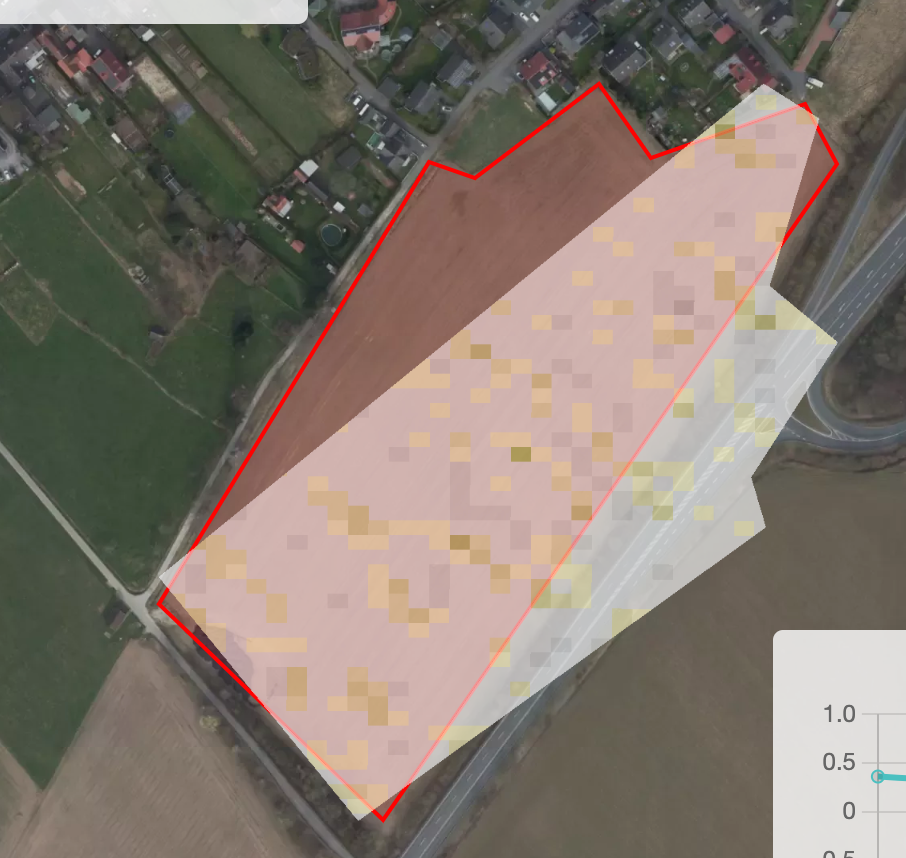
I am using “ogc/wms/” api and NDVI layer i am using
//VERSION=3
function setup() {
return {
input: ["B04", "B08", "SCL","dataMask"],
output: [
{ id: "default", bands: 4 },
{ id: "index", bands: 1, sampleType: "FLOAT32" },
{ id: "eobrowserStats", bands: 2, sampleType: 'FLOAT32' },
{ id: "dataMask", bands: 1 }
]
};
}
function evaluatePixel(samples) {
let val = index(samples.B08, samples.B04);
let imgVals = null;
// The library for tiffs works well only if there is only one channel returned.
// So we encode the "no data" as NaN here and ignore NaNs on frontend.
const indexVal = samples.dataMask === 1 ? val : NaN;
if (val<-0.5) imgVals = [0.05,0.05,0.05,samples.dataMask];
else if (val<-0.2) imgVals = [0.75,0.75,0.75,samples.dataMask];
else if (val<-0.1) imgVals = [0.86,0.86,0.86,samples.dataMask];
else if (val<0) imgVals = [0.92,0.92,0.92,samples.dataMask];
else if (val<0.025) imgVals = [1,0.98,0.8,samples.dataMask];
else if (val<0.05) imgVals = [0.93,0.91,0.71,samples.dataMask];
else if (val<0.075) imgVals = [0.87,0.85,0.61,samples.dataMask];
else if (val<0.1) imgVals = [0.8,0.78,0.51,samples.dataMask];
else if (val<0.125) imgVals = [0.74,0.72,0.42,samples.dataMask];
else if (val<0.15) imgVals = [0.69,0.76,0.38,samples.dataMask];
else if (val<0.175) imgVals = [0.64,0.8,0.35,samples.dataMask];
else if (val<0.2) imgVals = [0.57,0.75,0.32,samples.dataMask];
else if (val<0.25) imgVals = [0.5,0.7,0.28,samples.dataMask];
else if (val<0.3) imgVals = [0.44,0.64,0.25,samples.dataMask];
else if (val<0.35) imgVals = [0.38,0.59,0.21,samples.dataMask];
else if (val<0.4) imgVals = [0.31,0.54,0.18,samples.dataMask];
else if (val<0.45) imgVals = [0.25,0.49,0.14,samples.dataMask];
else if (val<0.5) imgVals = [0.19,0.43,0.11,samples.dataMask];
else if (val<0.55) imgVals = [0.13,0.38,0.07,samples.dataMask];
else if (val<0.6) imgVals = [0.06,0.33,0.04,samples.dataMask];
else imgVals = [0.06,0.33,0.04,samples.dataMask];
return {
default: imgVals,
index: [indexVal],
eobrowserStats:[val,isCloud(samples.SCL)?1:0],
dataMask: [samples.dataMask]
};
}
function isCloud (scl) {
if (scl == 3) { // SC_CLOUD_SHADOW
return false;
} else if (scl == 9) { // SC_CLOUD_HIGH_PROBA
return true;
} else if (scl == 8) { // SC_CLOUD_MEDIUM_PROBA
return true;
} else if (scl == 7) { // SC_CLOUD_LOW_PROBA
return false;
} else if (scl == 10) { // SC_THIN_CIRRUS
return true;
} else if (scl == 11) { // SC_SNOW_ICE
return false;
} else if (scl == 1) { // SC_SATURATED_DEFECTIVE
return false;
} else if (scl == 2) { // SC_DARK_FEATURE_SHADOW
return false;
}
return false;
}
But i am unble to show image in the MAP with polygon data. I need to change my code.
Like attached the image