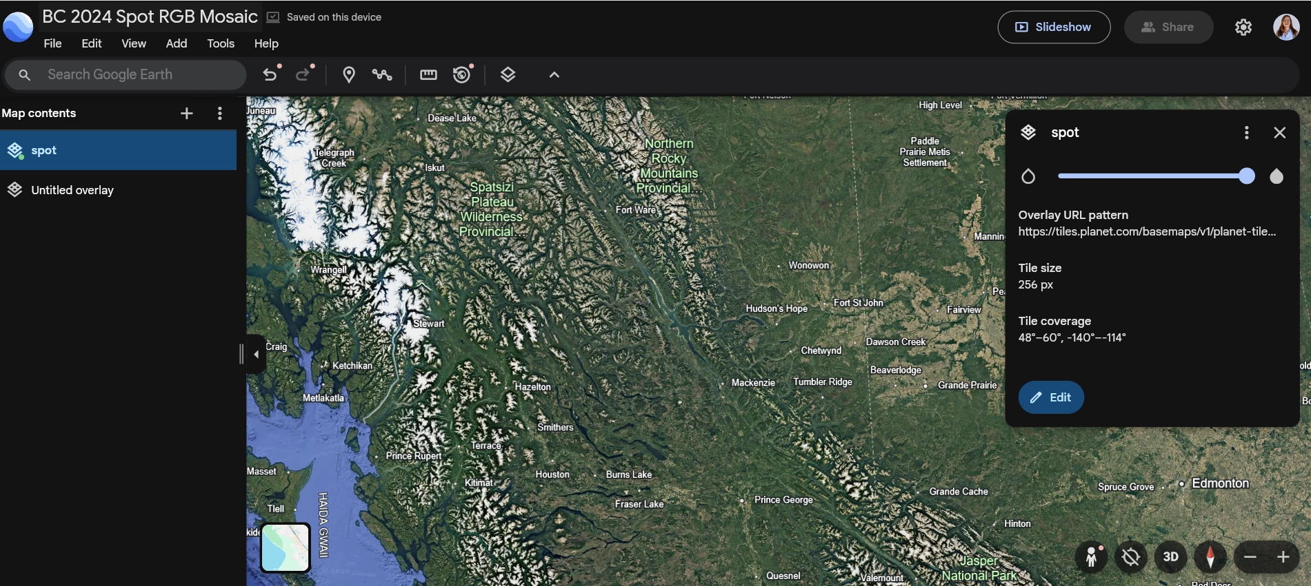
Hi all,
Some of our field staff would like to be able to view the SPOT mosaic which is served up as WMTS layer in Google Earth, either desktop or online. Is there a way to do that?
Thanks!
SN

 +1
+1Hi all,
Some of our field staff would like to be able to view the SPOT mosaic which is served up as WMTS layer in Google Earth, either desktop or online. Is there a way to do that?
Thanks!
SN
No account yet? Create an account
Enter your E-mail address. We'll send you an e-mail with instructions to reset your password.
© 2026 Planet Labs PBC. All rights reserved.
| Privacy Policy | California Privacy Notice |California Do Not Sell
Your Privacy Choices | Cookie Notice | Terms of Use | Sitemap