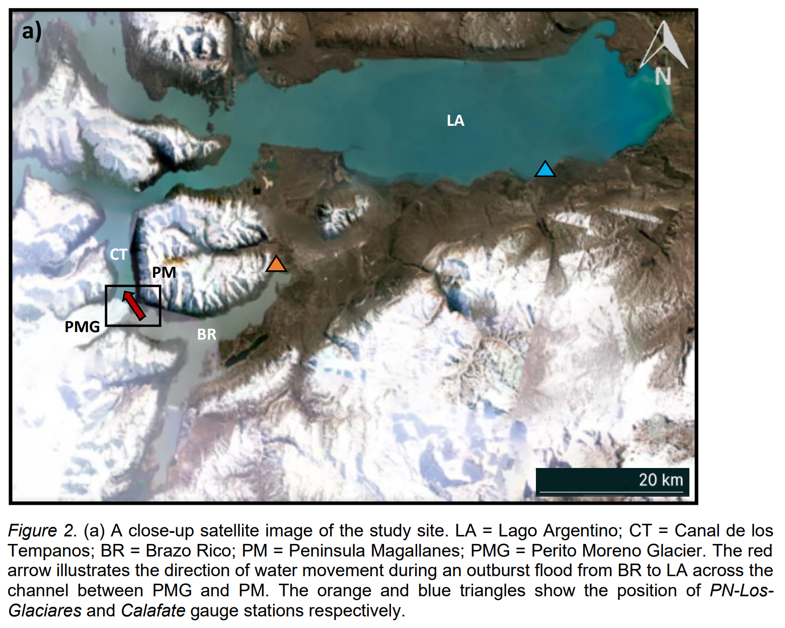
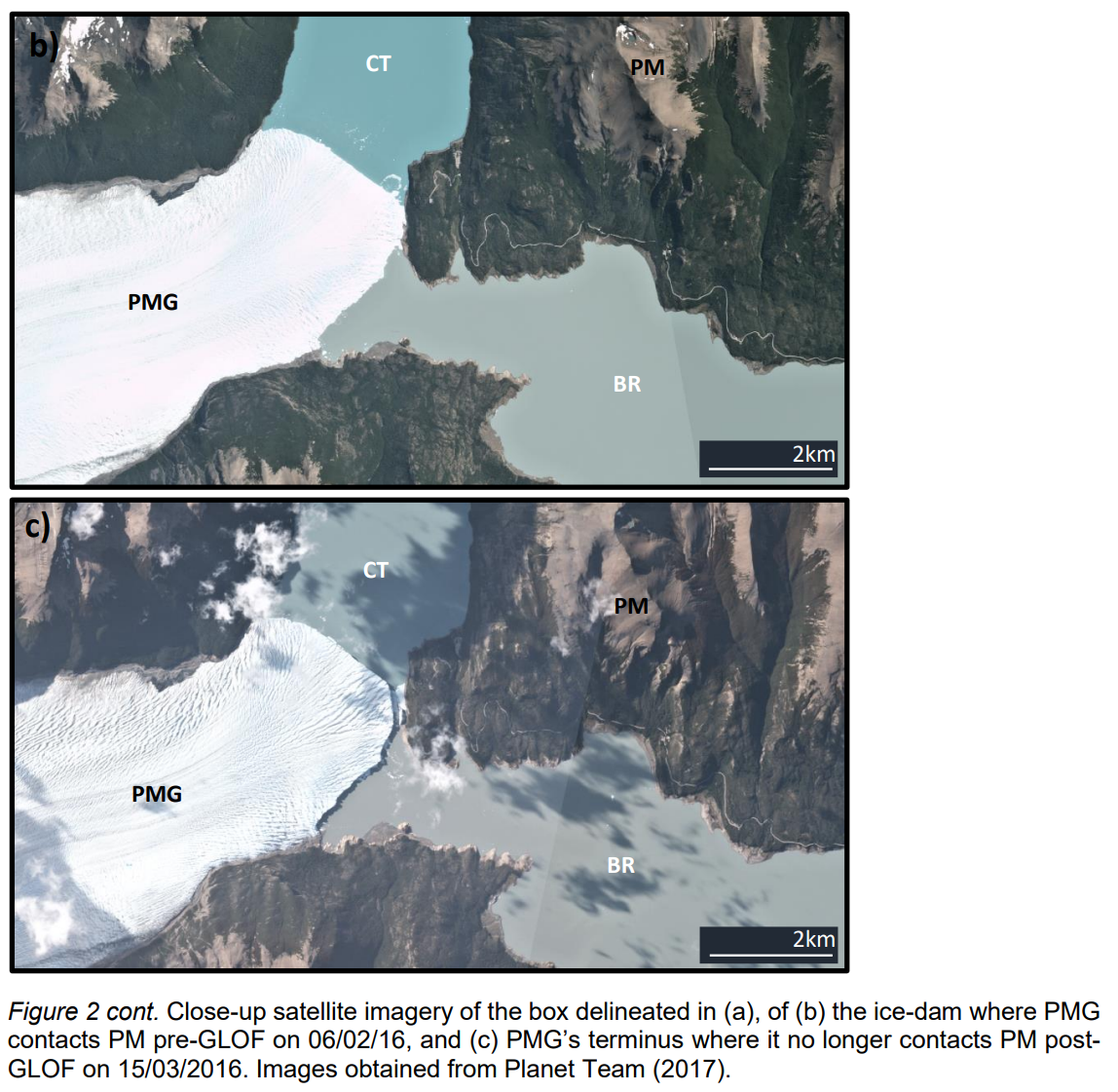
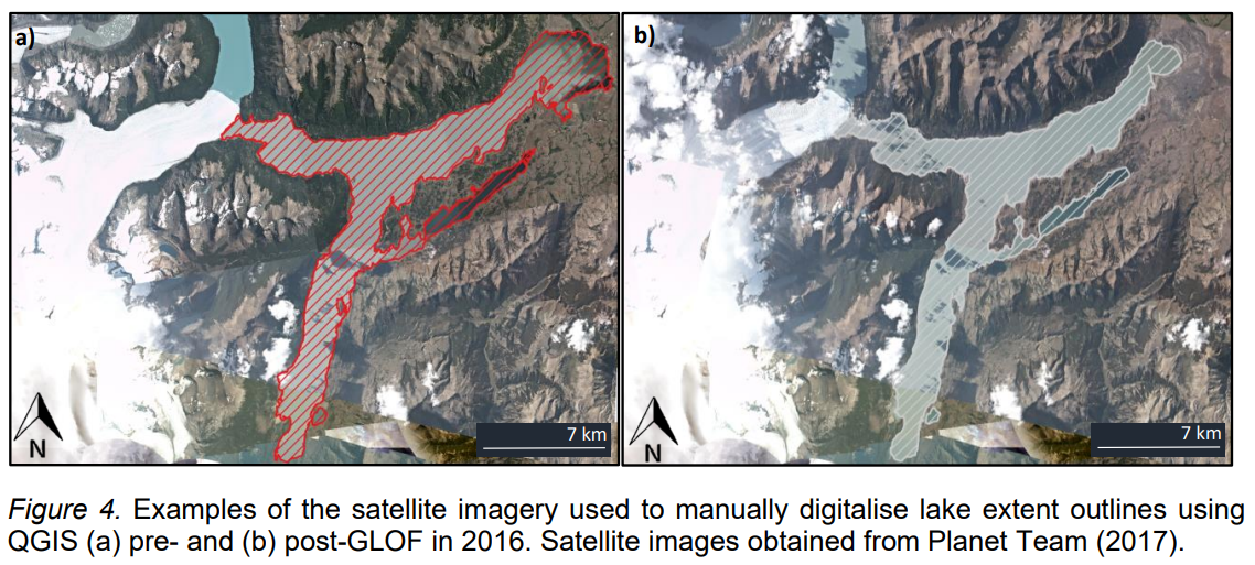
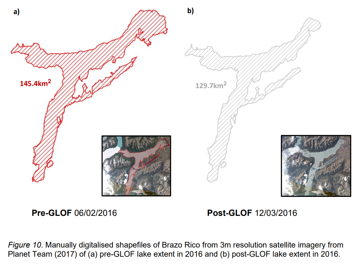
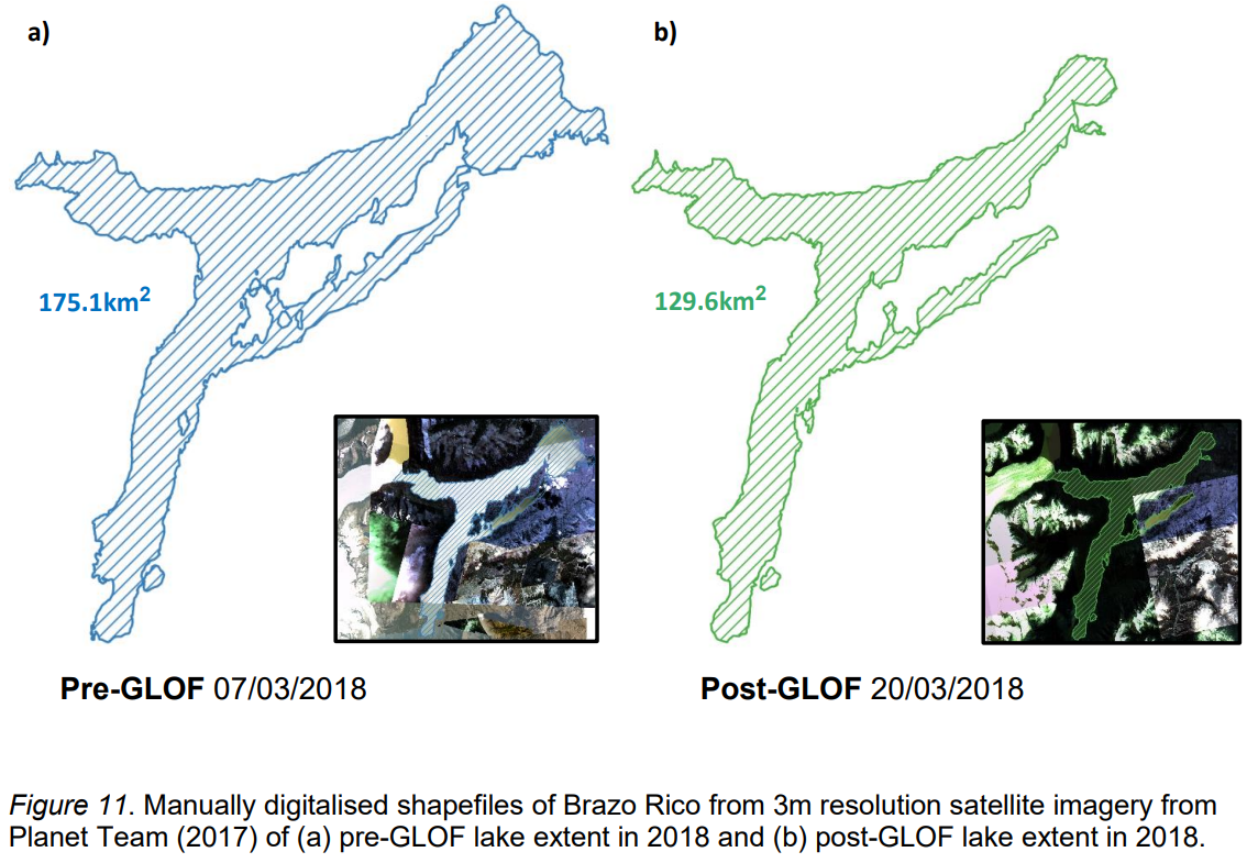
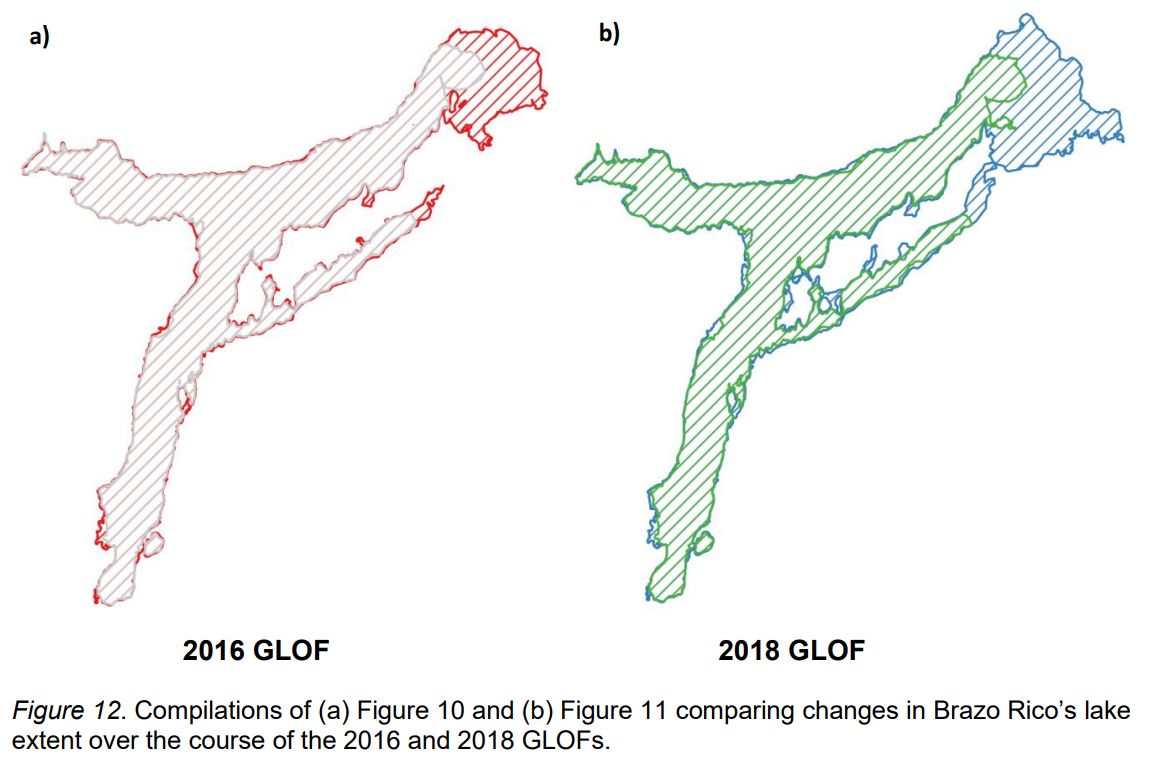
Here I present some of the research outputs from my analysis of the 2016 and 2018 Glacier Lake Outburst Floods (GLOFs) in the Brazo Rico-Lago Argentino lake system in Argentina. Below is a collation of the key diagrammatic representations of how I utilised Planet data to inform and guide my analysis. In QGIS, I measured changes in lake area and glacier advance using these images and aligned this with lake depth data to provide a reconstruction of the dynamics of the 2016 and 2018 damming and GLOF events. Please reach out if you are interested to discuss or see more of my study’s outputs!
![](https://uploads-us-west-2.insided.com/planetlabs-en/attachment/52ff7d74-7399-44e1-abe5-1ea511798b0c.png)
![](https://uploads-us-west-2.insided.com/planetlabs-en/attachment/50ad1e17-5322-4074-bd59-0e413129ba0e.png)
![](https://uploads-us-west-2.insided.com/planetlabs-en/attachment/b515fc76-d391-435f-82ae-0e363a963820.png)
![](https://uploads-us-west-2.insided.com/planetlabs-en/attachment/9fd39c6a-1773-4aaa-98d9-e8eaea55fb56.png)
![](https://uploads-us-west-2.insided.com/planetlabs-en/attachment/1a914533-a8a9-405a-925e-c3f629d3eb52.png)
![](https://uploads-us-west-2.insided.com/planetlabs-en/attachment/ab67463e-0ad3-4501-9d14-f39ab213141c.png)