Hi everyone and welcome to the Competition! There are some great questions already, so we wanted to share some additional technical resources to help folks get familiar with Tanager.
- Introduction to Tanager- this is a course that gives an overview of the Tanager satellite fleet
- Tanager Docs - this is the official documentation page
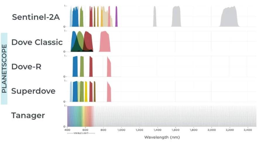
- Tanager Technical Specification - this includes the full tech spec for each product type
- Ask AI- Here on Planet Community, or over on Planet University, Planet Documentation, or the Help Center you can find the Ask AI button in the top navigation, this AI agent indexes all of the previously mentioned recourses!!
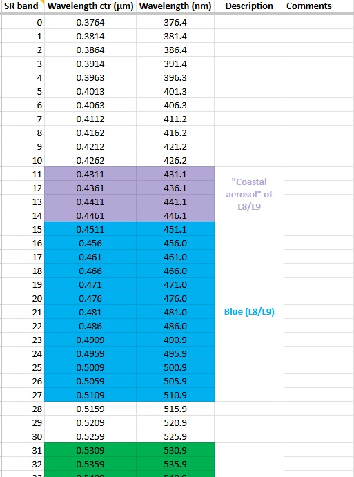
- Data Quality Reports for Tanager Constellation
We will also be sharing some technical walkthroughs to help folks get started over the coming weeks. Keep the conversations coming!