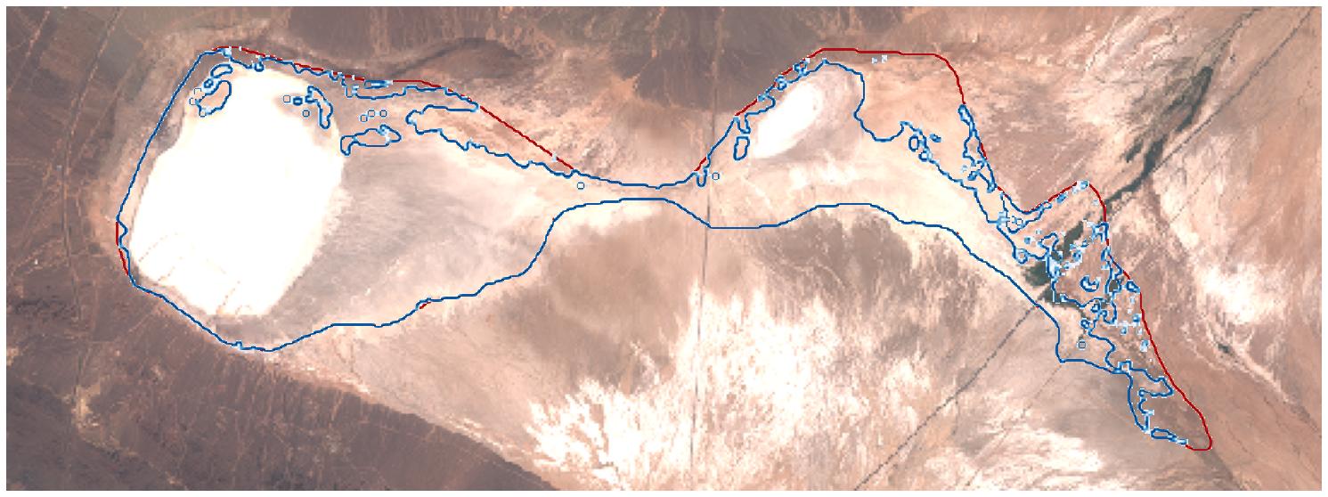
I am using the code here provided in sentinel-hub. I noticed that this code calculates the area of the lake as close to 100% for lakes where the water has completely dried up at some point in time. while it should be calculated close to 0%. What could be the cause of this issue? Is the data resolution effective in this?


Please look at the picture. Detected water segments are essentially dry.

I changed the resolution but there was no change in the calculated value.

Hi, thanks for the question. NDWI is an imperfect method to detect water, the index is actually very sensitive to built up areas and bright non-vegetated surfaces. This maybe what is causing the overestimation of surface water here.


You could try this water body detection custom script to see if you get better results.


Is this estimation occurring in every acquisition you are using, or is it unique to this example you have shown here?


Lastly, just want to confirm in the image you have provided the red line is the original lake extent, and the blue line is the detected water?


Thanks 🙂


thanks for your response


It seems that there is this problem in wetlands located in the Middle East region. In this index, the dry soil of this area cannot be distinguished from the shallow water. I think if the threshold NDWI can be changed, better results can be obtained. But there is no such parameter in this code.


This topic was automatically closed 60 days after the last reply. New replies are no longer allowed.


Reply