Hi there,


I can download 16 (.TIFF) and 32 bit (.TIFF_d32f) formatted data for my region of interest, but not 8-bit ones.


I have tried all the suffixes as defined by documentation. https://www.sentinel-hub.com/faq/how-are-values-calculated-within-sentinel-hub-and-how-are-they-returned-output


and as defined in in (constants.MimeType) – expected image form folder.


I cannot rely on the png.format.


Teo

Hi Teodor,


Sentinel Hub services support 8-bit tiff format. You can obtain it by specifying format=image/tiff;depth=8 in WMS/WCS/WMTS request. Here is the list of supported output formats: https://www.sentinel-hub.com/develop/documentation/api/output-formats


However if you are talking about obtaining data with sentinelhub Python package - at the moment the package only supports 16-bit tiff (MimeType.TIFF) and 32-bit float tiff (MimeType.TIFF_d32f). But, if required, we can easily extend support to 8-bit tiff as well.


Hi,

I was indeed talking about the second of the two. It would be very helpful if you could extend it to support 8-bit tiff as well. Can you please let me know once it has been implemented, with an appropriate extension to be used.

Thanks,


Update done - sentinelhub Python package now has new data format types MimeType.TIFF_d8 and MimeType.TIFF_d16 (the later actually provides the same data as MimeType.TIFF). With MimeType.TIFF_d8 you will be able to download 8-bit tiff images.

This update has just been released in new package version 2.0.3. You can install it with pip install sentinelhub --upgrade

Best regards,


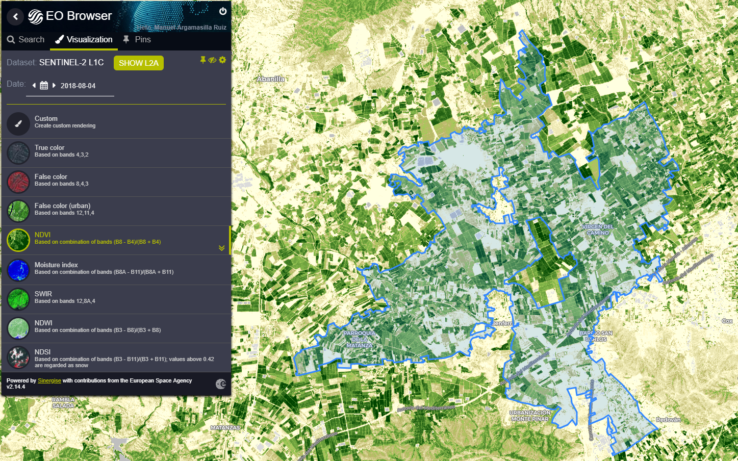
Hi all!, I’m experiencing troubles when I try to download an image from a kml file (polygon). The statistical info about NDVI or SMI is ok (time series are generated) but none of the possible image formats work (jpg, png, tif, kmz, …), with the error “400 Oops! Something went wrong”.


I attach a screenshot of EO Browser with the abovementioned kml file.

Thank in advance!


Hi,

to know for sure, you would need to post KML file here as well, but I am guessing that it is too large geometry, e.g. too many points, which causes an error in the service. I suggest yo simplify it a bit.

We are working on service improvements to be able to handle such requests, but it will take a couple of weeks more.


working on service improvements

You’re right! I’ve manually drawn a polygon with less points and it works.

Thank you so much!


Reply