
I have a problem with downloading the tif of a large region, for example, London.

The bounds of it is [-0.853878, 51.105198,0.9580, 52.0926], so I created a bbox

london_box = BBox(bbox=[-0.853878, 51.105198,0.9580, 52.0926], crs=CRS.WGS84),

and got a tif, in which I got ‘‘Sentinel hub bounding box area is too large,please zoom in’’.

So I tried to split it to 4 sub-bbox, but you can find white gaps between outputs like below:


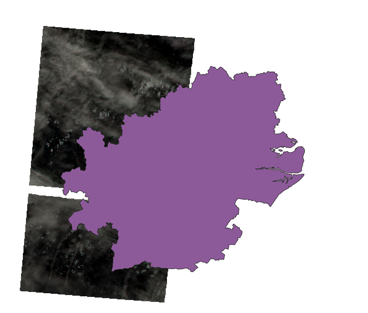
what should I do to avoid these?

There is indeed a maximum size for the service call, 5.000 x 5.000 px.

I am not sure, why you get these while borders - this is certainly something you can avoid if you construct requests in an appropriate manner.


Perhaps sentinelhub-py package could be of use:

favicon.svgGitHub
a1bb1ffd69236ea7d807ca79f4754b2dd886a72b.png


GitHub - sentinel-hub/sentinelhub-py: Download and process satellite imagery...


Download and process satellite imagery in Python using Sentinel Hub services. - GitHub - sentinel-hub/sentinelhub-py: Download and process satellite imagery in Python using Sentinel Hub services.


Reply