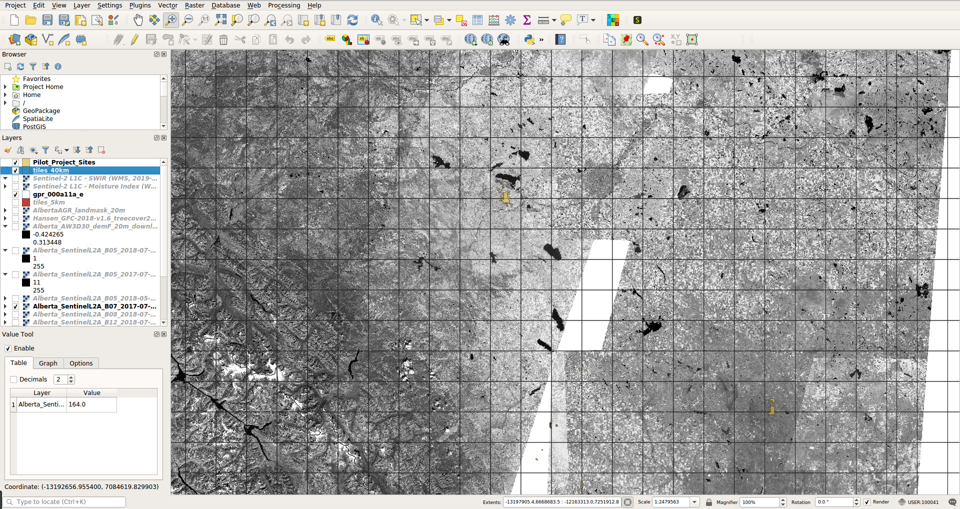
I am trying to download cloud-free Sentinel-2 bands “B03”,“B04”,“B05”,“B06”,“B07”,“B08”,“B11”,“B12” using WCS for the whole province of Alberta (Canada) at 20 m resolution; out of it I would like to make a cloud-free mosaic. I have made the following function (R) for this:
get_shub = function(i, tileS.tbl, COVERAGE="B03", TIME='2019-03-01/2019-06-01', RES=20, priority='leastCC', wcs.id="bec83f1b-4183-492d-b60a-d19408cc925d", out.dir="/data/Pachaterrae/data/shub"){
  out.png <- paste0(out.dir, "/T", tileS.tbl[i,"ID"], "/T", tileS.tbl[i,"ID"], "_", COVERAGE, "_", plotKML::normalizeFilename(TIME), "_", RES,"m.png")
  bbox = paste(round(tileS.tbl[i,1:4],1), collapse = ",")
  if(!file.exists(out.png)){
require(curl)
Sys.sleep(.2)
x = download.file(paste0('https://services.sentinel-hub.com/ogc/wcs/', wcs.id, '?SERVICE=WCS&REQUEST=GetCoverage&COVERAGE=', COVERAGE, '&SHOWLOGO=false&MAXCC=5&priority=', priority, '&CRS=EPSG:3857&BBOX=', bbox, '&RESX=', RES, '&RESY=', RES,'&FORMAT=image/png&TIME=',TIME), out.png)
system(paste0('gdal_translate -of Gtiff -a_ullr ', paste0(round(tileS.tbl[i,c(1,4,3,2)],1), collapse = " "), ' -co \"COMPRESS=DEFLATE\" -a_srs \"EPSG:3857\" ', out.png, ' ', gsub(".png", ".tif", out.png)))
  }
}
I have run this function using tiling system (40 x 40 km) to avoid the WCS limit of 5000 x 5000 pixels and for various dates (TIME=‘2019-04-01/2019-06-01’, TIME=‘2018-05-01/2018-07-01’, TIME=‘2018-07-01/2018-09-01’). The resulting mosaic looks like this:
There are two problems with this mosaic:
A. For over 15% of the area I get missing pixels. Basically mosaic needs to be made again.
B. For about 10-20% of the area I still get clouds.
Note that for the WCS parameters I have used ‘MAXCC=5&priority=leastCC’ hoping that this would solve the problems of clouds.
My three questions are:
- Have you maybe made some seasonal cloud-free products with Sentinel-2 bands that I could use? I am interested in 1-2 month periods in 2017-2019.
- Note that I download the images as PNGs then I have to convert them to TIFs - is this the only way to get GeoTIFFs from the SH WCS? Which WCS parameters would you recommend to download cloud-free / missing-pixels free Sentinel 2 bands for a larger area?
- The download speed using WCS is excellent and I managed to run the function above in parallel (in <8hrs it downloaded 400GB of data). This is fantastic - your WCS is amazing!! But my account limits me to 100,000 requests per month (is this correct?). That means that by running downloads for <24hrs would result in me using all my credits.
Maybe I should look at downloading all cloud-free scenes for a more narrow time period and then producing cloud-free / artifacts-free mosaics?
thanks in advance,
Tom Hengl
About - OpenGeoHub Foundation: Connect | Create | Share | Repeat
We harness the power of Machine Learning and Geo-computations for Global Good, enabling and accelerating organizations in producing analysis-ready &


