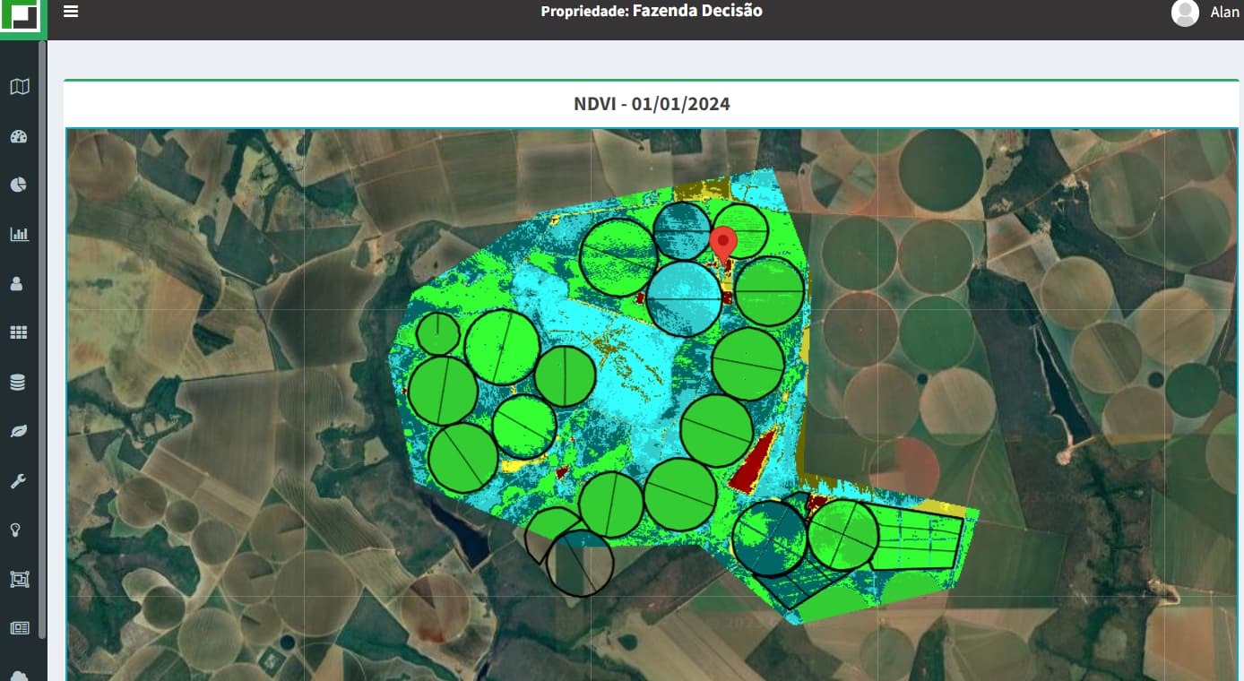
Hello, I have a system to help rural producers with crop irrigation.

I’m trying to apply NDVI with Sentinel HUB on my Google Maps.


When I pull the data from the WMS with Layer NDVI, I can get it right, but when I try to follow the documentation to use a custom evalscript, I get a 400 error.


var url = “https://services.sentinel-hub.com/ogc/wms/3c******************************************”;

url += “?REQUEST=GetMap”; //WMS operation

url += “&SERVICE=WMS”; //WMS service

url += “&VERSION=1.1.1”; //WMS version

url += “&LAYERS=B01,B02,B03”

url += “&EVALSCRIPT=cmV0dXJuIFtCMDgqMi41LEIwNCoyLjUsQjAzKjIuNV07”

url += “&FORMAT=image/png” ; //WMS format

url += “&PREVIEW=2”;

url += “&CRS=EPSG:4326”;

url += “&GAIN=1”;

url += “&GAMA=0.8”;

url += “&TRANSPARENT=true”; //set WGS84

url += “&BBOX=” + bbox; // set bounding box

url += “&QUALITY=100”;

url += “&WIDTH=512”; //tile size in google

url += “&HEIGHT=512”;

url += sentinel_points;


https://services.sentinel-hub.com/ogc/wms/3cc**************************************?REQUEST=GetMap&SERVICE=WMS&VERSION=1.1.1&LAYERS=B01,B02,B03&EVALSCRIPT=cmV0dXJuIFtCMDgqMi41LEIwNCoyLjUsQjAzKjIuNV07&FORMAT=image/png&PREVIEW=2&CRS=EPSG:4326&GAIN=1&GAMA=0.8&TRANSPARENT=true&BBOX=-47.373046875,-16.46769474828896,-47.28515625,-16.383391123608387&QUALITY=100&WIDTH=512&HEIGHT=512&GEOMETRY=POLYGON((-47.336822%20-16.411344,-47.30146%20-16.404757,-47.29528%20-16.420565,-47.296653%20-16.449543,-47.269531%20-16.455141,-47.273307%20-16.466335,-47.298027%20-16.471932,-47.312446%20-16.46008,-47.332359%20-16.460409,-47.356048%20-16.45086,-47.360168%20-16.43275,-47.356391%20-16.4232,-47.336822%20-16.411344))


Above I have my URL creation.


Thanks for helping.

Hi,


Thanks for the question. This seems like it is probably an issue with the evalscript itself. Have you tried testing the script using Process API in Request Builder or in EO Browser?


If you are still having issues with it, then if you share the script here, we can help debug it.


Reply