
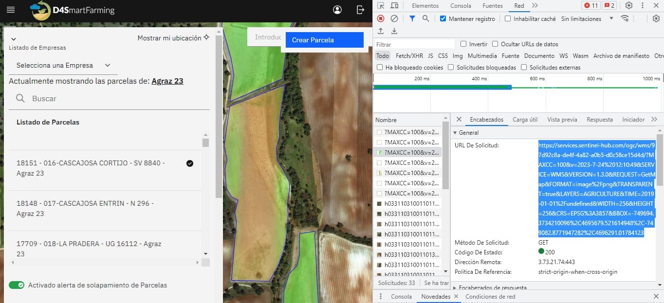
Good morning, I am writing to you because a strange behavior is occurring when requesting the image via ogc, because we request the image using the following url


https://services.sentinel-hub.com/ogc/wms/97d92c8a-de4f-4a82-a0b5-d0c58ce15d4d/?MAXCC=100&v=2023-7-24%2012:10:49&SERVICE=WMS&VERSION=1.3.0&REQUEST=GetMap&FORMAT=image%2Fpng&TRANSPARENT=true&LAYERS=AGRICULTURE&TIME=2019-01-01%2Fundefined&WIDTH=256&HEIGHT=256&CRS=EPSG%3A3857&BBOX=-749694.3734210096%2C4695679.521614948%2C-749082.8771947282%2C4696291.01784123


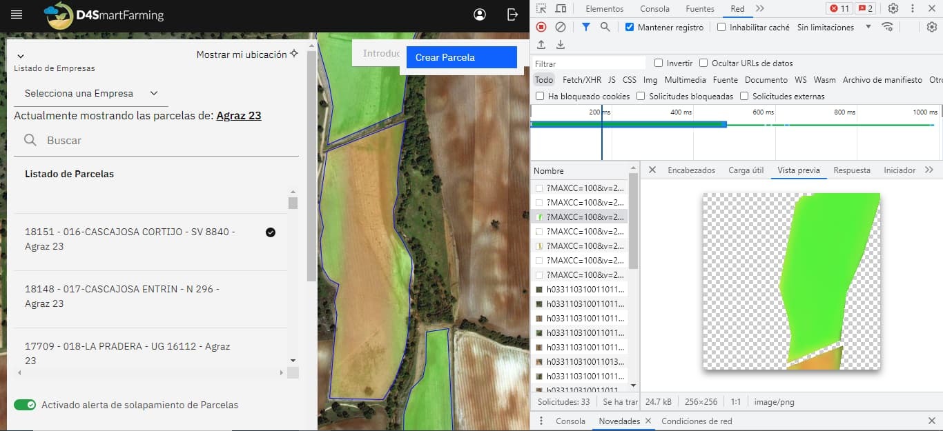
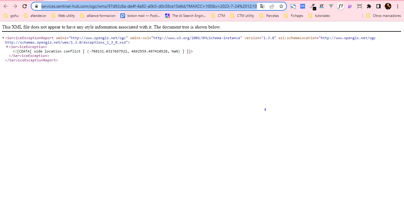
However, this request sometimes responds correctly and on other occasions returns a 500 error with the following error


I attach images of the tests carried out


thank you in advance I say goodbye

Hello Compras,


the area of interest in your instance self-intersects near the point 38.82694676783655, -6.418258432187035 in WGS84, so your query sometimes fails. You can see the self intersection highlighted in this image:


Here is also an image of the geometry of your area of interest with a circle in the south-east corner of your area of interest highlighting where the self-intersection point is so you can find it more easily:


I suggest creating a new instance, since the geometry of the area of interest cannot be changed in the dashboard. To clarify, normally the configuration instance’s map bounds can be edited through dashboard, however in your case the geometry is too complex for that. You can change it with the API although you would have to firstly GET your data and only change the AOI and then create a PUT request with this data.


Thank you very much for the answer, I proceed to do what you told me


This topic was automatically closed 60 days after the last reply. New replies are no longer allowed.


Reply