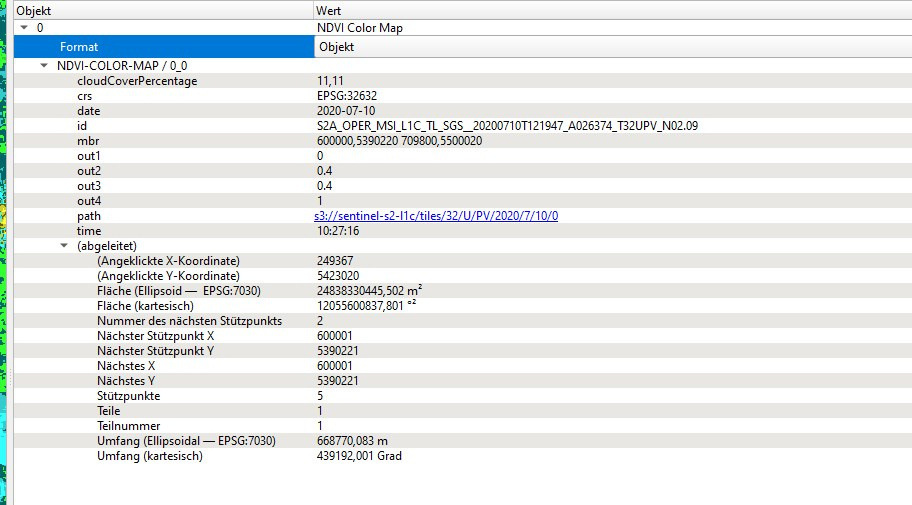
Which service specifically are you referring to? Is this WFS’ response example?
NDVI Index value. The example mentioned above is the corresponding WMS service
NDVI (Normalized Difference Vegetation Index) - INDEX
//VERSION=3
function evaluatePixel(samples) {
let val = index(samples.B08, samples.B04);
return [val, samples.dataMask];
}
function setup() {
return {
input: [{
bands: [
“B04”,
“B08”,
“dataMask”
]
}],
output: {
bands: 2
}
}
}
I imagine you are using “GetFeatureInfo” part of the WMS service, right? If so, that one is more or less fixed.
What you could however do is use our “processAPI” and its geojson output as shown here:
docs.sentinel-hub.com
Sentinel Hub is multi-spectral, temporal satellite imagery service for real-time processing of big remote sensing data.
Check also tip 9 here:
Medium – 15 Jun 21
15 tips for better scripts and more responsive requests
Reading time: 7 min read
With this you should be able to construct a response in line with your liking.