Hi,

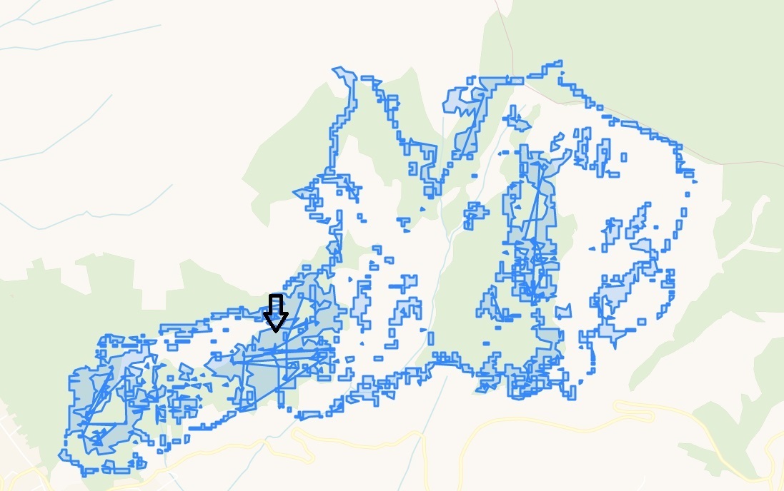
I uploaded a .kmz file with some polygons for which i need to monitor the NDVI trend for a certain time inside these areas. However, the uploaded file appears with some overlapped lines that cause problems for the analysis (see the attached image), even if in arcgis is ok. How can i solve this issue?

Have you by chance tried uploading said geometry in geojson or similar? kml is a tricky beast sometimes…


thank you.I’m working in arcgis, do you know how may i get a geojson to export?


I don’t know about ArcGIS, but QGIS can handle both, and allows exporting to geojson.


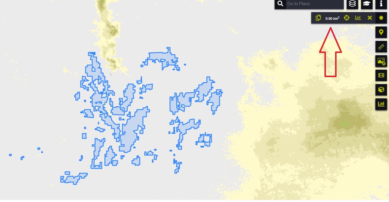
yes, i solved it by means of QGis. Thanks for your suggestion. Just one last curiosity, is it normal that EO-browser can’t compute the area of the sum of the polygons? it gave me 0 km^2. ! (please, see the figure)


That seems like an error. If you don’t mind, could you share geojson with me (via private message)?


Hey 


Just one last curiosity, is it normal that EO-browser can’t compute the area of the sum of the polygons? it gave me 0 km^2.

We just deployed a new version of EO Browser (v3.4.0) which now also deals correctly with multipolygons.

Best,


Reply