Hello,
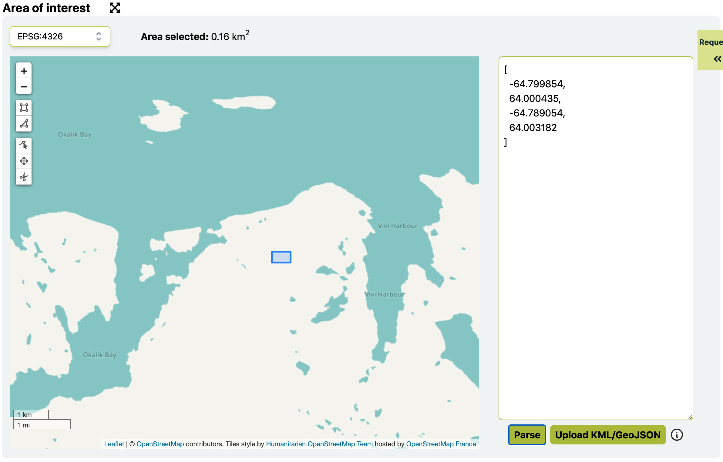
I have a data frame of more than 10,000+ rows. In corners, I have longitude and latitude of the 4 corners of the bounding box.
My question is SentinelHub requires us to have WGS-84 Coordinates, So how can I convert these latitudes and longitudes (of 4 corners) into WGS-84 coordinates so that I can download all the images from the data frame.
Note: I am not using the free trial version of the sentinel hub.
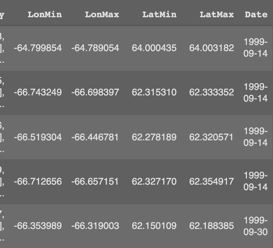
Eg. of the data I have in dataframe.
Thank you,