Good morning everyone,

I’m a new user, sorry for my english.

I am an independent archaeologist.

Could someone help me with the satellite images? I joined this forum, it was recommended to me by the Sentinel Team, as I was looking for an infrared image, the one I downloaded from the portal, is NOT High Definition.

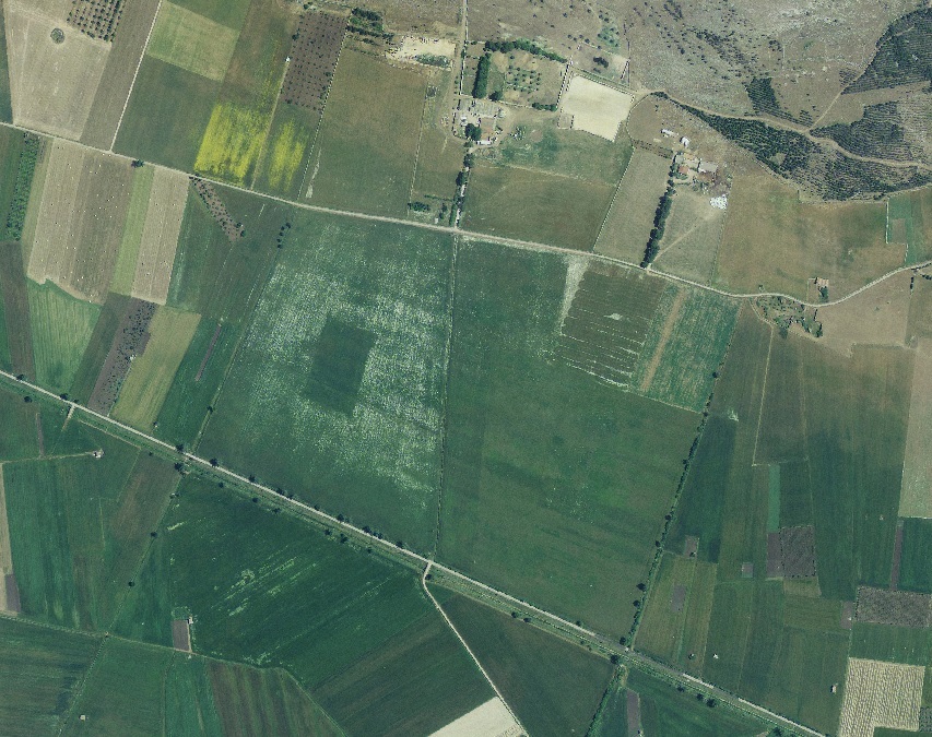
I tell you this because I discovered, through Google Earth, an anomaly in the terrain that would suggest an ancient structure, perhaps a Roman Domus or something else.

I need infrared images or multispectral satellite images to better understand the nature of the terrain anomaly.

I report the coordinates of the anomaly and I ask you forum users for help.

this is the anomaly observed from an aerial photo - April 2008 altitude 6000 meters


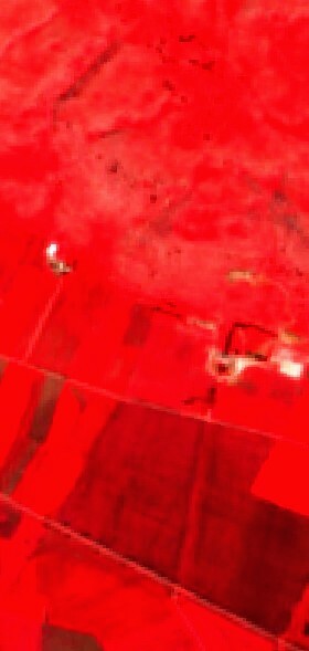
this is the image i downloaded from sentinel, it is NOT sharp, clear…

I need a High Definition, as I wrote in the previous post


Hi, welcome to the forum and the world of satellite imagery!


Sentinel-2, the sensor you are using in this instance is limited by its resolution which is 10m x 10m for each pixel. Therefore, it will never look as “sharp” as aerial photography.


A good middle ground for this is commercial satellite imagery that we also provide access to. Currently, we offer access to:


  • Planet’s PlanetScope data 3.7-4.1m resolution

  • Planet’s SkySat data 0.5-0.9m resolution

  • Airbus’s Pleiades data 0.5 m for panchromatic band and 2 m for all other bands

  • Airbus’s SPOT data 1.5 m for panchromatic band and 6 m for all other bands

  • Maxar’s WorldView data Varies from 0.3m to approx. 2m. SH supports 0.5 m for panchromatic band and 2 m for multispectral bands.

However, you would have to purchase this data. If interested, check our webinar on Commercial data, where you CAN learn how to search and order commercial data using the API, visualize it in EO Browser, generate time-series and view statistical information, import data into QGIS and get commercial data sponsored.


If you have any other questions, please let us know and we will be happy to help 🙂


I understood what you wrote referring to the Sentinel-2 images, I will never get the sharpness.

For commercial satellite images, I don’t have the economic means to buy them.

I am also not familiar with computers and various software.

If someone can help me, looking for multispectral and infrared satellite images, also historical, referring to the place of the anomaly, I would be happy to post them on this forum.
The images you provide will help me compare them to obtain more objective data.
In case the results are positive, it will be my care to inform the authorities responsible for antiquity, for scientific excavations (I’m Italian).

For those who want to help me here are the coordinates of the terrain anomaly of which the 2008 aerial photo.
40°44’16"N 16°44’40"E • 357m;

Thanks for the attention


Is there anyone you can help me decipher that terrain anomaly? If indeed it is a structure (Roman Domus) still underground.

Thank you


Reply