
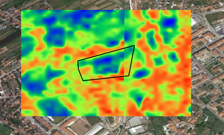
Hi, I’m trying to use the python module to acquire the S-2 NDMI for a specific area, but when I save them to my local drive they have some sort of glitch, like it was a result of merging two images. I checked the EO Browser and they seem fine. It only happens using the Python module. Image is attached.

Hi,

Could you say a bit more about how did you construct this image? (a code snippet would be appreciated).


Here is the request:


wms_NDMI_request = WmsRequest(

data_folder=save_dir,

data_collection=collection,

layer=‘MOISTURE-INDEX’,

bbox=box.buffer(buffer),

maxcc=0.05,

# geometry=Geometry(geometry=geo, crs=CRS.WGS84),

width=512,

time=(start_date, end_date),

image_format=MimeType.TIFF,

config=config

)


That request in principle should not result in such a discontinuity, but it also depends on configuration of your ‘MOISTURE-INDEX’ layer, as well as on the start_date/end_date properties.


If you send me parameters, (including your instance_id, using DM functionality), I can have a look.


Just to add that this kind of a result is typically a consequence of either:


  • stiching the data from different observations (e.g. if FROM/TO date are not the same)

  • using Sentinel-2 L2A, where the atmospheric corrections, being run on the scene level, is sometimes a bit diffenent on neigbouring tiles (something that ESA is planning to address in the reprocessing campaign).


Reply