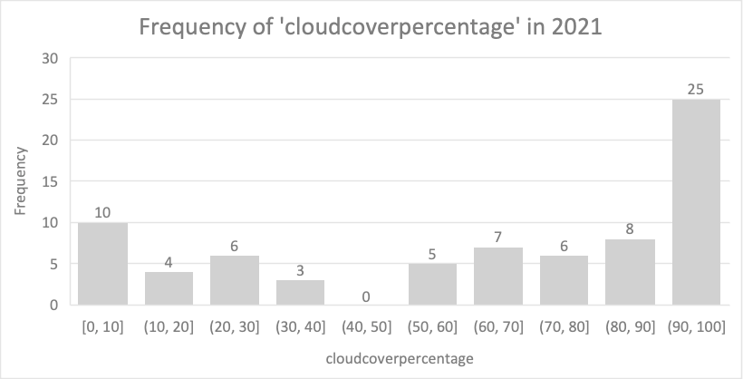
Hi there, the following graph shows the frequency of cloud percentage of a Sentinel-2 L1C tile in 2021, and it seems like only 10 dates have cloudcover less than 10%. I am wondering:
1, How much percentage of cloudcover is considered as “good quality” or “clear” for calculating NDVI directly? If it’s 10%, then there are actually only a few images that can be used.
2, For those images with a high cloudcover percentage, how could we do the “cloud masking” to get rid of the cloud effect using QGIS plugins (or python packages)?


