
Hi,
I can’t understand why S2-L2A raw data downloaded via EO Browser have different pixel size from raw data downloaded via API request. I’ll try to show you better what I mean.
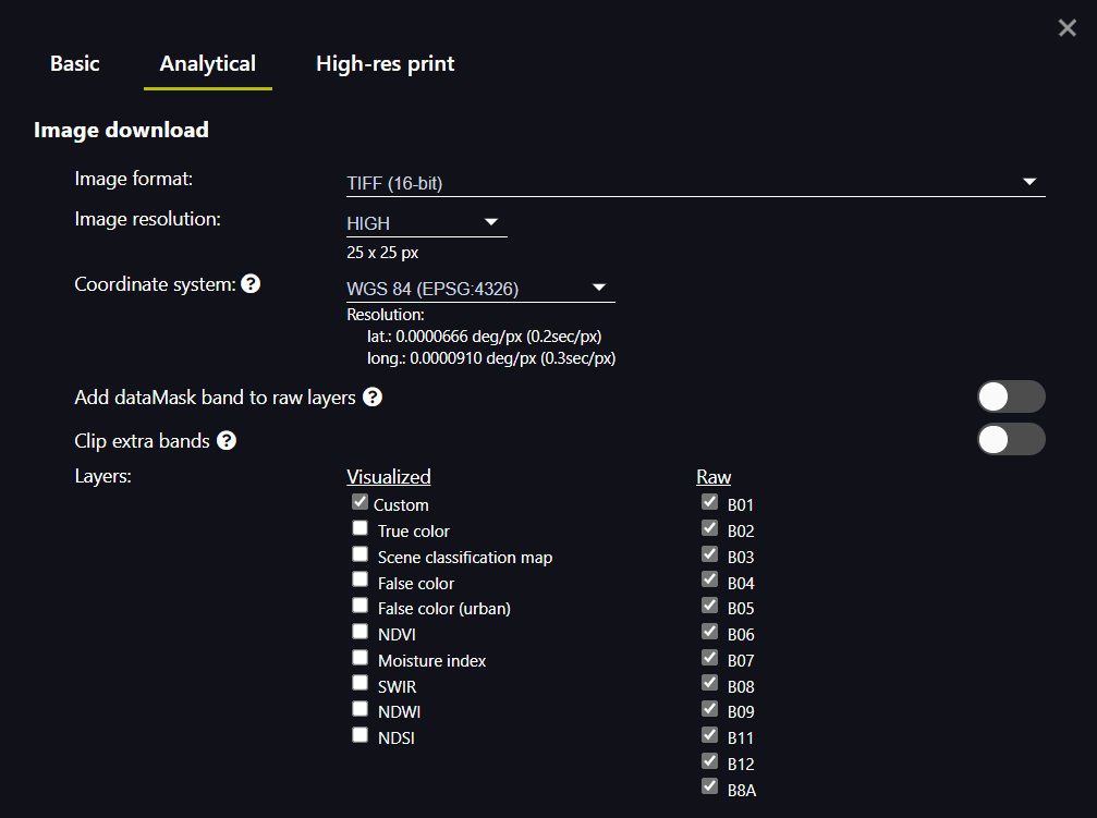
I managed to download all S2-L2A’s raw bands value following the example shown in Sentinel Hub Process API — Sentinel Hub 3.3.2 documentation (sentinelhub-py.readthedocs.io). In addition to this, being that the maximum spatial resolution for S2-L2A is 10m (as documentation said, the bands with lower resolutions will be automatically upscaled), I set resolution = 10, when specifying bbox size.
resolution = 10
betsiboka_bbox = BBox(bbox=betsiboka_coords_wgs84, crs=CRS.WGS84)
betsiboka_size = bbox_to_dimensions(betsiboka_bbox, resolution=resolution)
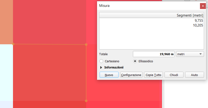
Checking the .TIFF file (2021-09-07.tiff) via QGIS, the pixel size seems to correspond.
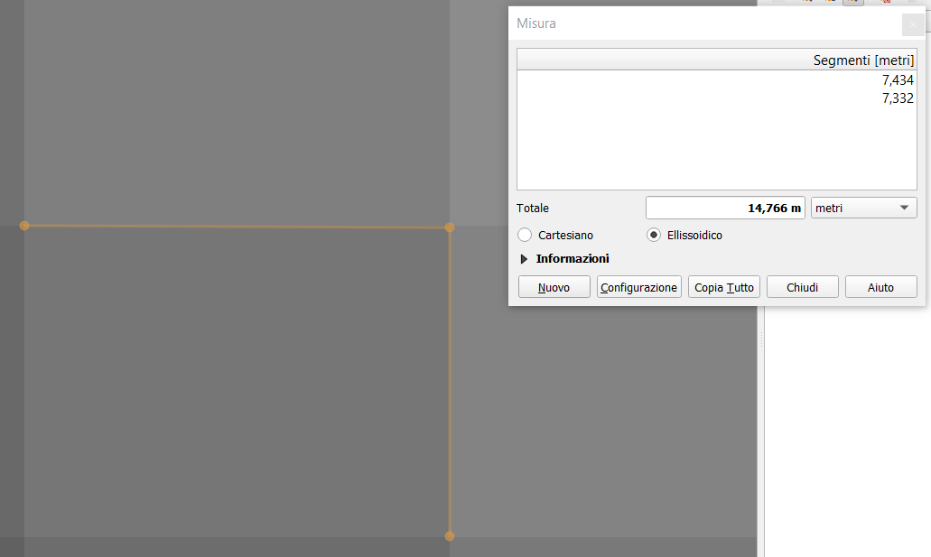
When downloading the same raw data via EO Browser (I used a .geoJSON polygon to call for the same bbox), I get images with different pixel size.
This is what I get when I open “B01” and all the other bands.
Shouldn’t I have the same raw data? Can someone help me understanding why I get this?
Thanks a lot for the help!
2021-09-07.tiff (4.5 KB)
2021-09-07-00_00_2021-09-07-23_59_Sentinel-2_L2A_B01_(Raw).tiff (1.3 KB)
