Hello,
I just want to know the satellite azimuth information for PS2.SD L1B images which I downloaded.
I found that there are two types of metadata: GeoJSON metadata and General XML metadata.
And the definitions of the "satellite_azimuth" in GeoJSON metadata and "azimuthAngle" in General XML metadata are quite different.
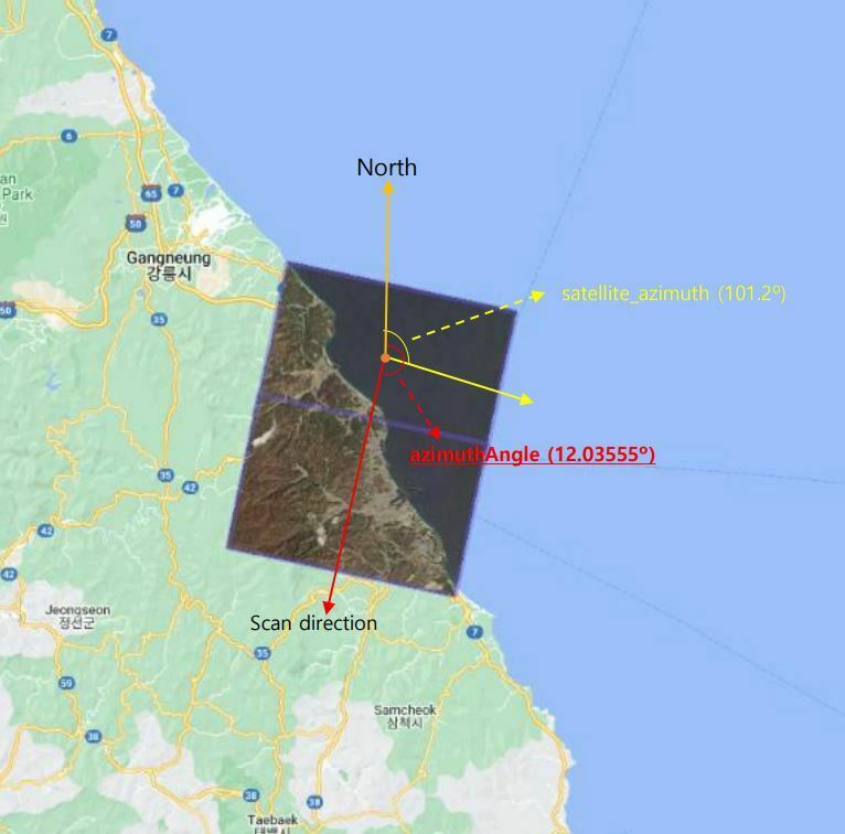
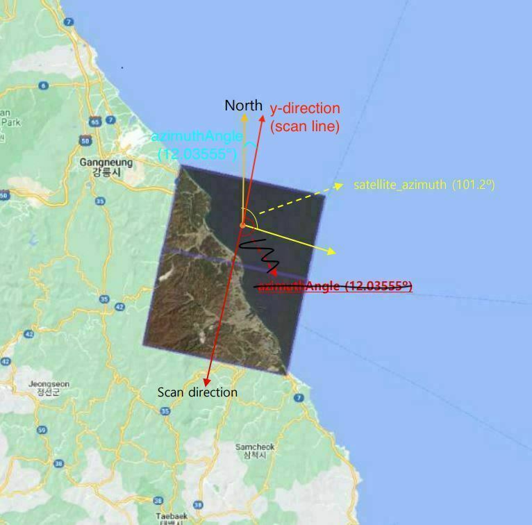
In case of "azimuthAngle" in General XML metadata, "azimuthAngle" means "The angle from true north at the image to the scan (line) direction at image center, in clockwise positive degrees" from the PLANETSCOPE PRODUCT SPECIFICATIONS document.
The "orbitDirection" of my PS2.SD L1B image is "DESCENDING" so I thought the scan (line) direction must be equal to a direction like following figure in consideration of how PS2.SD image composite were made.
However, I found that "azimuthAngle" is 1.203555e+01 in General XML metadata and it doesn't make sense because I think “azimuthAngle” must be at least over 90º.
So, I want to know what I missed...
Thanks.
(I used ‘20190408_015325_76_105a_1B_AnalyticMS’ image.)


