
EOMAP -a world leading company for optical remote sensing of marine and freshwater environments and one of Planet’s partners, has recently published their work on how they reveal the details and possible reasons for massive fish kill in the Oder River between Germany and Poland, using Planet data. As algae has been considered as one of the significant causes of this disaster, researchers at EOMAP could focus on algae bloom with regard and location thanks to the frequent and precise satellite data.
“Planet’s daily satellite images were able to show for the first time, in great accuracy, where and how quickly chlorophyll concentrations and other water quality parameters developed downstream of the Oder River over this summer,” Dr. Marcus Apel, Director of Business Development at Planet.
Read the full article in English.
Read the full article in German.
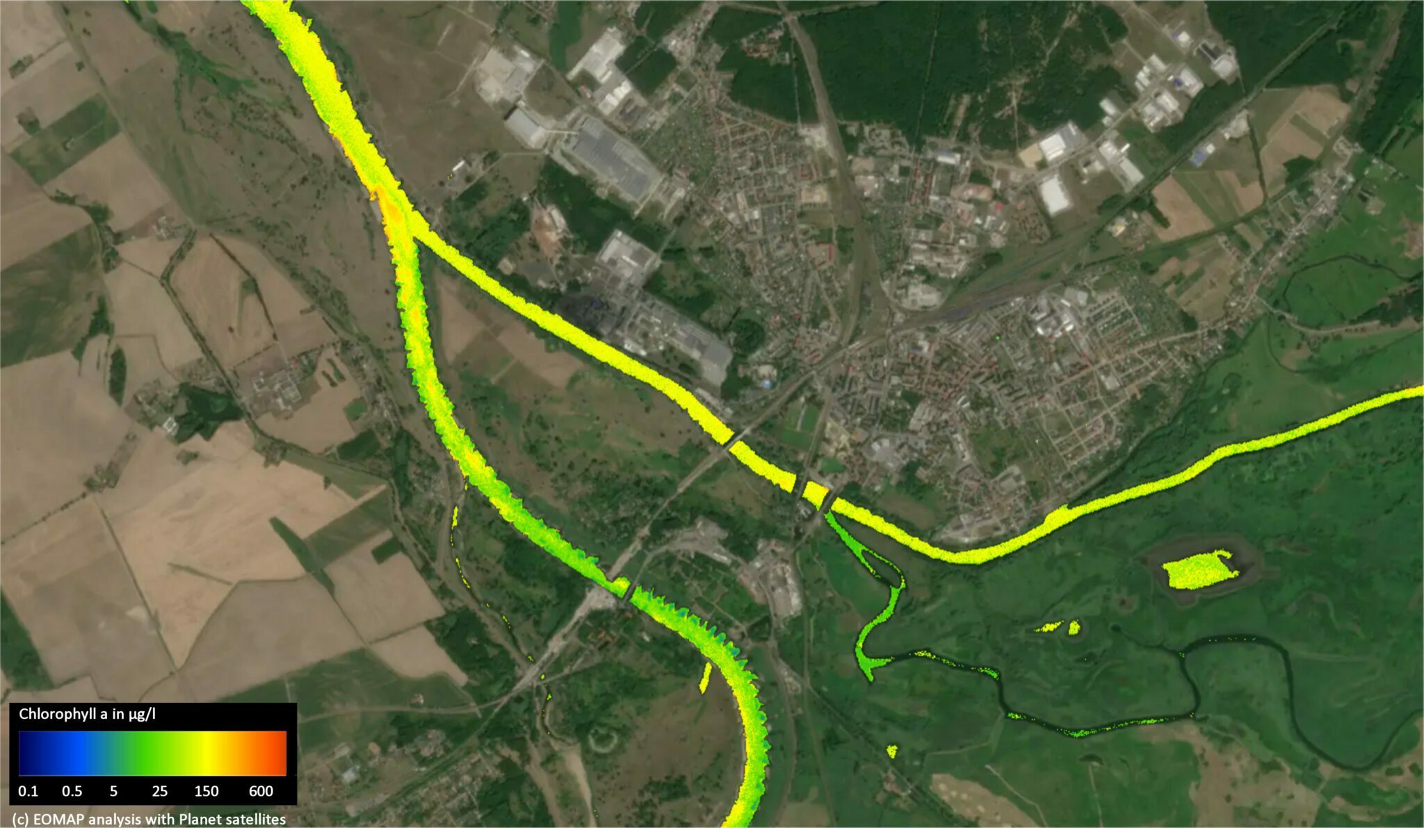
Image Info: Researchers discovered that the Oder River has been affected by the tributaries like Warthe on the right, increasing the level of algae in the Oder River. https://www.eomap.com/press-release-satellite-data-reveals-details-of-oder-river-disaster/
