

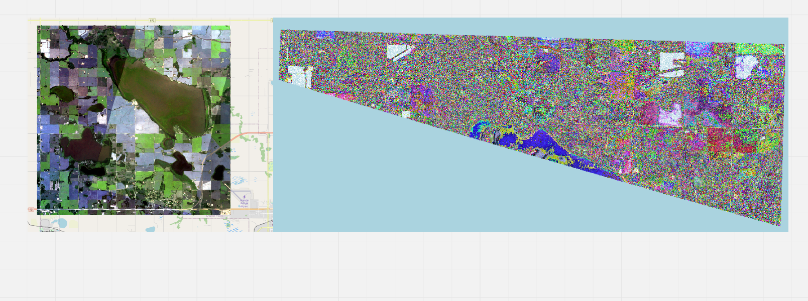
- See above image. I’m having an issue where in some versions of QGIS my downloaded PlanetScope imagery looks like the right image where the bands seem to be shortened/ not rendering properly at all and the error of “this file is not georeferenced”. Is there a known source for this problem?

2. At times, select geotiffs state the properties of the geotiff state that there are no labelled bands, just that one band out of the 4 is “Gray”. Is there a resource that explains the meaning/source of this and how this may impact my data? (see above image)
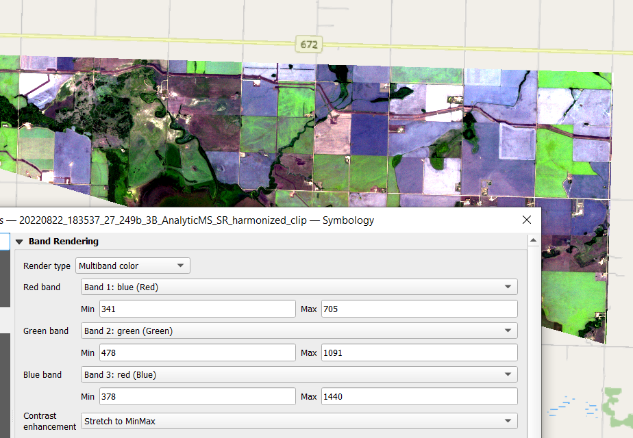
- From question 1, the image on the left. I am told that the the correct order of the bands is BGR but The RGB bands are inconsistently labelled with Band 1: blue (Red) - what is the reasoning behind this and what is the true intended color of the band? (see above image)


