Solved

Dust Detection with Planet Images

  • 11 April 2023
  • 5 replies
  • 147 views

Userlevel 1
Badge +2

Hello everyone,


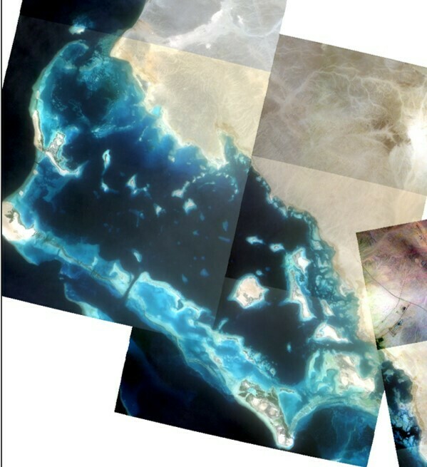
I am studying dust storm effects in the oceans. I want to use satellite imagery to improve the results of my project. However, I am having issues with dust visualization in ArcGIS.

I did a table with the following features:

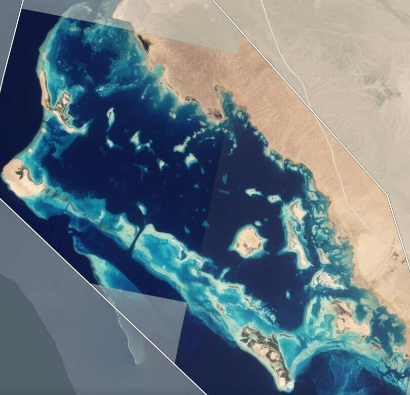
In the first column, you can see Planet explorer. On the left, you can see a clear day, while on the right, you can see a dusty day.

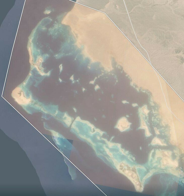
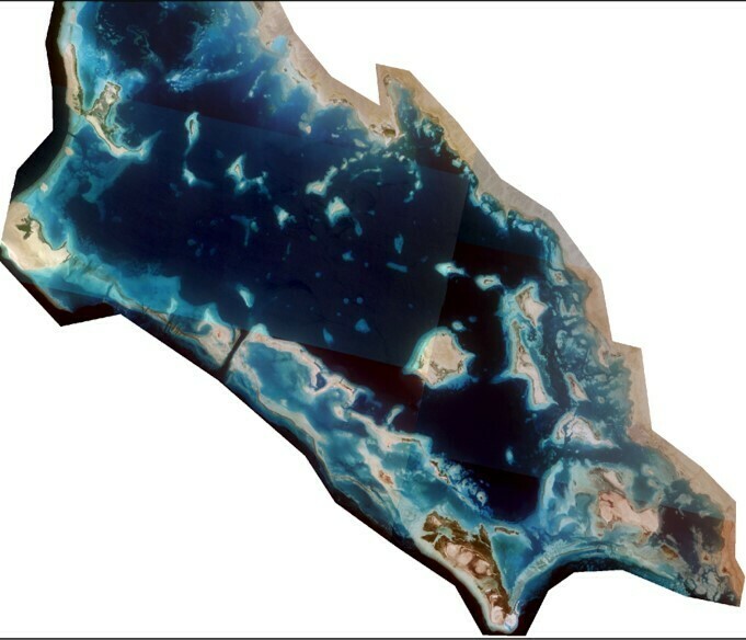
On the second column, they are the same images after being downloaded and then uploaded in ArcGIS Pro. On the left, the uploaded image is similar to the one shown in Planet Explorer. However, on the right, the image is not dusty, it does not look like the top-right image. 

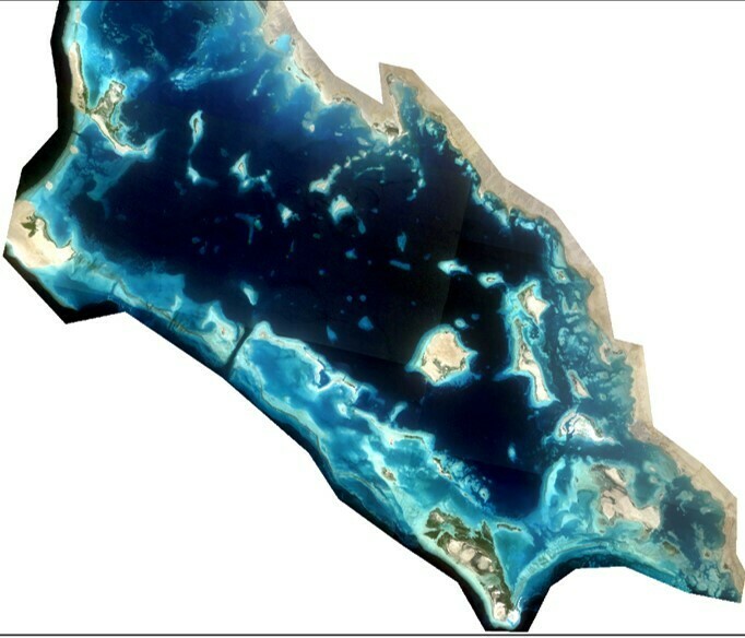
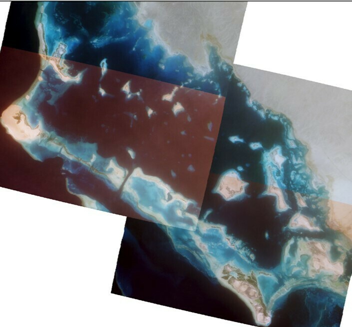
On the third column, I decided to use a Stretch (ESRI) on the image in ArcGIS Pro. Again, on the left, you see similar colors to the one visualized in Planet Explorer. On the image to the right, only the South West area looks different (perhaps dusty?) than the rest of the image. However, overall, the image still does not resemble the image visualized in Planet Explorer.

I want to be able to visualize dusty images on ArcGIS Pro, but even if Planet Explorer shows the dusty images, after downloaded they do not show the same dustiness. Does anyone know what is the issue? Perhaps is the way I am downloading images in Planet? A filter that removes aerosols? Or is it a way the image is uploaded in ArcGIS Pro?


Best regards,


icon

Best answer by idilgumus 3 May 2023, 22:42

View original

5 replies

Userlevel 6
Badge +8

Hi @Manuel Ariza,
We investigated your question and here is the answer:

The imagery in Explorer is normalized using a process that sometimes introduces an undesirable color balance compared to what one might subjectively desire using the full bit depth assets.Another thing is when applying a stretch, if it's applied per scene/image, it results in similarly "undesirable color balance" as per the bottom right example. This is because the stretch uses raster statistics to compute the resulting output image and because the distribution of colors varies (naturally) across the images, you can see they appear differently. But if the images were merged first, it would work better. For further investigation, could you please tell us:

  • the image ID,
  • Which asset you downloaded,
  • Was the determination of "dusty" simply from visual inspection or if you have a complimentary data source (e.g. some weather report, etc.)? 

Let us know if you have further questions.

Have a nice day! 

Userlevel 1
Badge +2


Dear Idilgumus,


Thanks for your reply.

Herein in this screenshot are the ID and asset types:

ID:6fa4f29d-c6ba-4811-b544-060ed15bfe1d

Asset types: ortho_analytic_4b_sr, ortho_analytic_4b_xml, ortho_udm2

As for the determination of dustiness, I do it from visual inspection. Most of the dust storms in this area (NW Red Sea) are originated from the tip of the Sinai Peninsula and the Gulf of Aqaba. When the NW Red Sea seems to be dusty, one can see the dust plumes originating the same day from these areas.


Best regards,


Userlevel 1
Badge +2

My apologies, I meant NE Red Sea

Userlevel 6
Badge +8

Hi @Manuel Ariza , 

“The difference in color balancing is actually caused by the surface reflectance process. This is what the analytic_4b_sr asset is - it attempts to compensate for atmospheric conditions, including dust. So the color is corrected but the image is still "hazy" in the sense that it's not very crisp but it does look more "natural".

So, you can benefit from something like https://zoom.earth/maps/satellite-hd/#view=26.2546,37.9492,8z/date=2021-08-05,am (set to the date of one of those examples) for verification. And then, you should use the visual or analytic, not sr products if color is important”

Let me know, if you have further questions 😊

Have a great day! 

Userlevel 1
Badge +2

Dear Idilgumus,


Thanks for your reply. You are right, now I have fixed the issue by just downloading the Planet images with no Surface reflectance. Thank you very much!!!


Reply