


For years, Thailand has been facing air pollution caused by burning sugarcane, which represents a major environmental problem in the country. A study analyzed this issue with high resolution satellite imagery combined with deep-learning technologies. Their goal was to analyze the location and extent of sugarcane in an effort to develop informed strategies to reduce burning.
To conduct the study, the researchers used Planet's high-resolution imagery through the NICFI Satellite Data Program and developed a deep learning algorithm. A U-Net deep learning algorithm was tested with a lightweight MobileNetV2 network as a coding branch via Google Earth Engine.
To conduct the study, the researchers used Planet's high-resolution imagery through the NICFI Satellite Data Program. They benefited from the integration of Google Artificial Intelligence and Google Earth Engine, which allows users to apply deep learning algorithms to geographic data at scale. All of these tools were able to help them monitor and map more accurately. The workflow can be seen below (Poortinga et al, 2021).
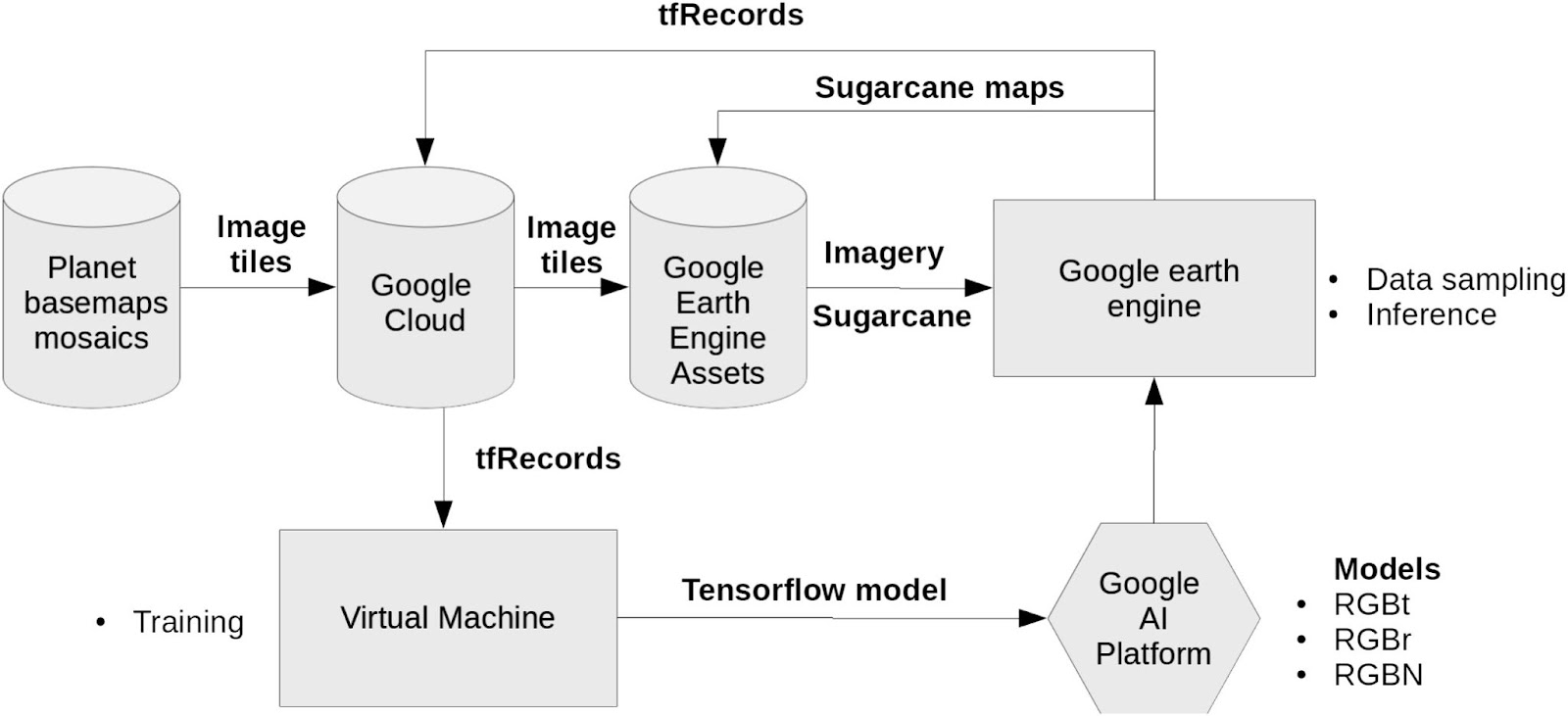
Image Info: https://www.sciencedirect.com/science/article/pii/S266739322100003X?via%3Dihub
The authors emphasize that high-resolution satellite imagery for land cover mapping has been out of reach for most organizations due to its high economic cost and computational requirements. However, through Norway's International Climate and Forest Initiative, high-resolution imagery has been made available to the public to support the development of new approaches to land cover mapping.
The key findings of this study are:
“ (1) lightweight deep-learning models can be effective strategies to map land cover within large areas with accuracies greater than 86 %;
(2) model-based transfer learning can be an effective strategy for land cover mapping, especially when limited data is available and furthermore yield higher accuracies than randomly initialized networks;
(3) an independent validation using a robust sampling strategy is advised to evaluate final model performance.”
For more details, please click to read the full article.
