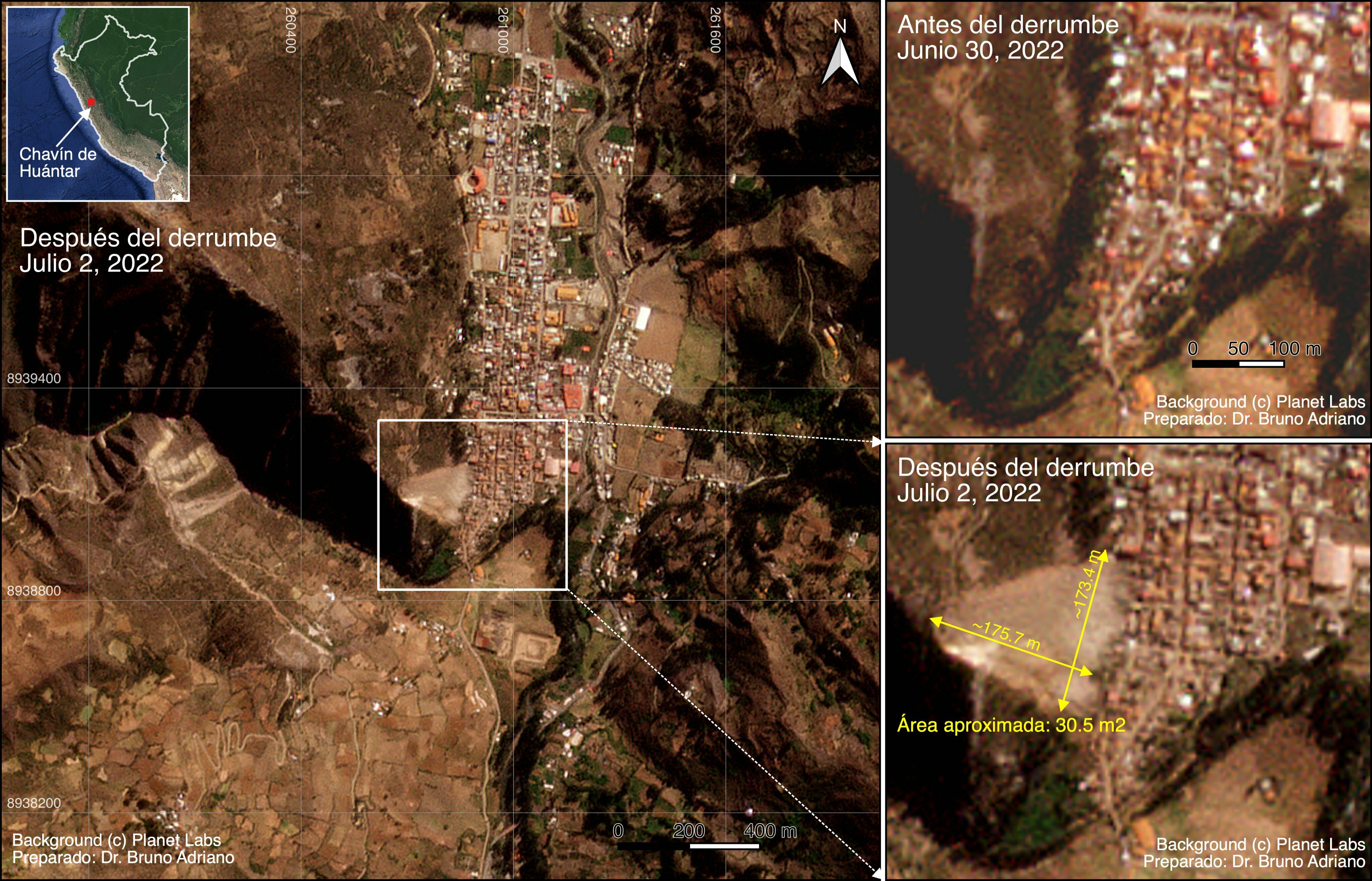
Hello, community. This is my first post. So, I want to share a quick application of Planet imagery for analyzing landslides. The study case is in a small province in Peru's Andes. This disaster destroyed more than 100 houses. Fortunately, there were very few fatalities. You can read more about this event at this link.