

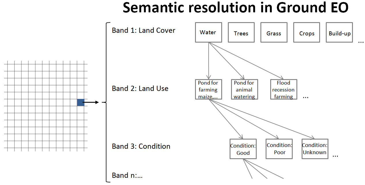
Indexing the Earth requires satellite data and ground data, but the latter are lacking. Satellite imagery allows us to observe from above the places that we mainly observe from the ground. This gives us a unique perspective of the places where we live, and an advantage to better understand our changing environment as compared to our ancestors who observed the Earth from the ground only. Now, the problem is that the systems that we are building to monitor the planet use mainly this new perspective from above, but not the perspective from the ground. Remote sensing cannot capture information such as the use of a building, a pond or a (sacred) tree; or crop and livestock diseases; or biodiversity under the tree canopy; or where are the fuzzy boundaries of a grazing or hunting area. Understanding land use change requires, fundamentally, land user-generated information.
The figure above shows the map created by agro-pastoralists communities in South West Ethiopia (left), a PlanetScope scene and the Google & WRI DynamicWorld Map of the same area. The question mark illustrates the need to transition towards more inclusive planetary-scale monitoring systems where local people have access to timely information and resources to address pressing issues and monitor the Earth from the ground.
The video below shows how freely available very high resolution imagery and Planet’s multi-temporal imagery provided by the NICFI program is integrated into the mobile app. The app is being used by agro-pastoralists communities to map and observe land use changes and identify water sources and grazing areas in good condition in the region, where a food security emergency is unfolding and conflicts need to be resolved before they escalate.
In the same way that many small satellites (e.g. PlanetScopes) are complementary to a few big satellites (e.g. Sentinels), many non-professional ground data collectors (i.e. local people) are complementary to a few professional ground data collectors (e.g. surveyors or enumerators). In the same way that only PlanetScopes can scan the Earth from space every day, only local people can scan the Earth from the ground every day. Put simply, local people are to surveyors what PlanetScopes are to Sentinels.
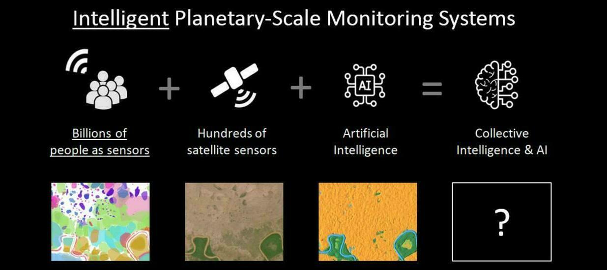
Our work to date highlights the need for investment in ground EO programs that can unlock the wisdom of the crowd, so the Earth can be indexed from space with hundreds of satellites and from the ground with billions of smartphones. While efforts are being made to activate and support networks of people with smartphones to bridge the global ground data gap, there is also the need to look at ground data differently. That is, to move away from highly reductionist approaches that use ground (truth) data only to train and validate satellite imagery analysis algorithms. To embrace semantic richness when generating and analysing ground data, in the same way that satellite EO embraces high spectral resolution. To transition towards intelligent planetary-scale monitoring systems that are capable of zooming in and in and in…
The pilot project in South West Ethiopia is a step towards democratising the access to satellite EO data and the production of ground EO data. For more information see:
- Wisdom of the Crowd in the Age of AI: Water
- An extreme citizen science approach to digital mapping in Ethiopia
- Crisis Mapping By Affected Agro-Pastoralists in Ethiopia: Crowdsourcing for Food Security?
