

Hi everyone! I wanted to post some fun content that we have created using some amazing SkySat 50cm Imagery, paired with 50cm SAR imagery from Umbra’s Open Data Program.
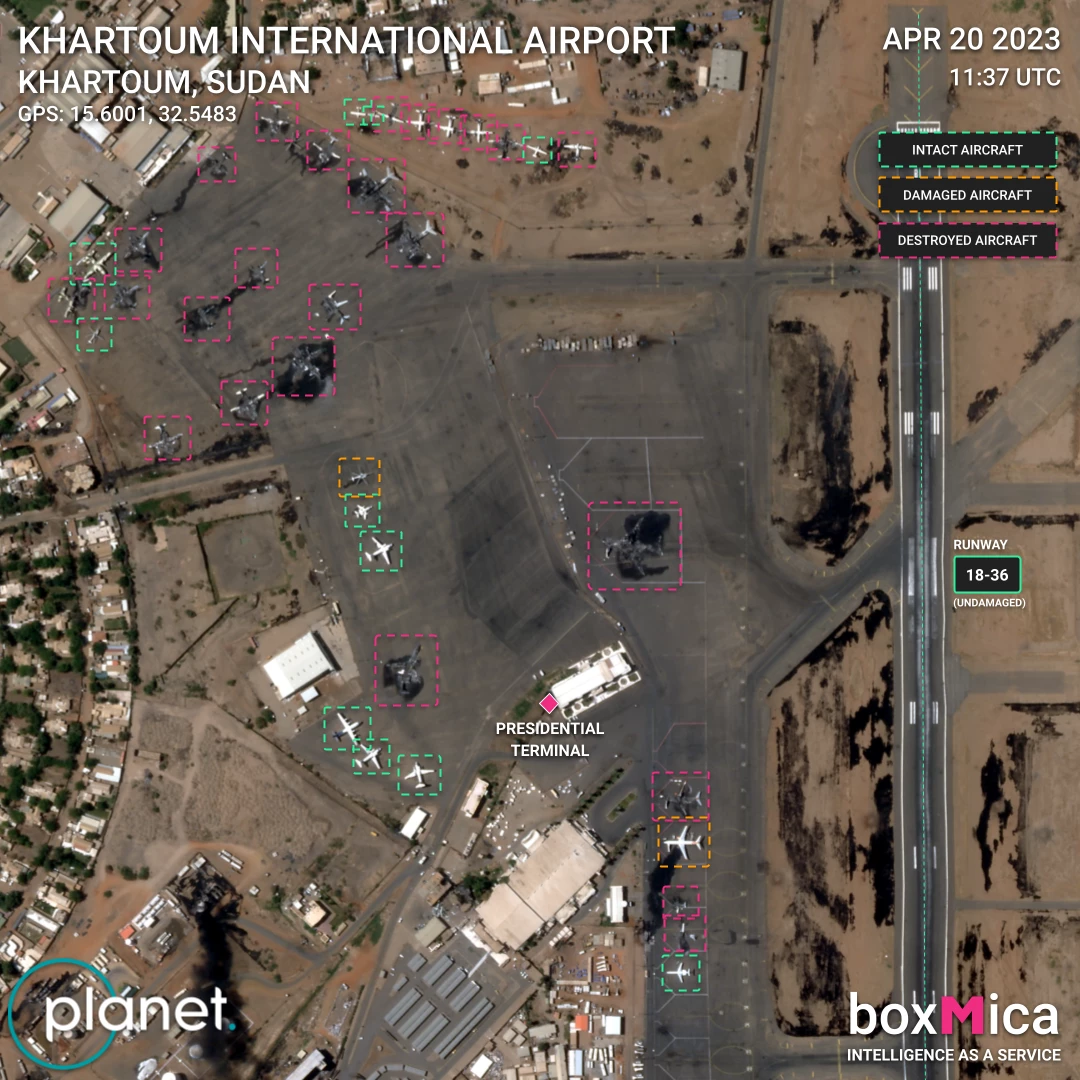
We have successfully used planet data to cowhitness/groundtruth unique object detection events for our geoint AI use case. In the below example, we were able to collect information on completely burned assets in Sudan. This will be critical in automating Battlefield Damage Assessments, where we can not only identify assets but also their state and context (for ex: damages vs destroyed assets, or gas/oil pooling around asset).
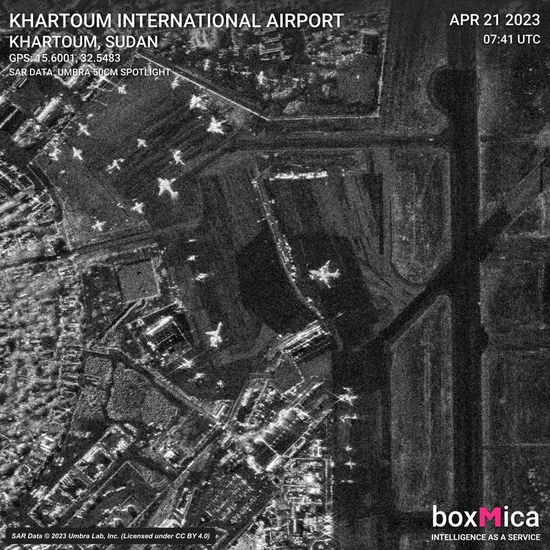
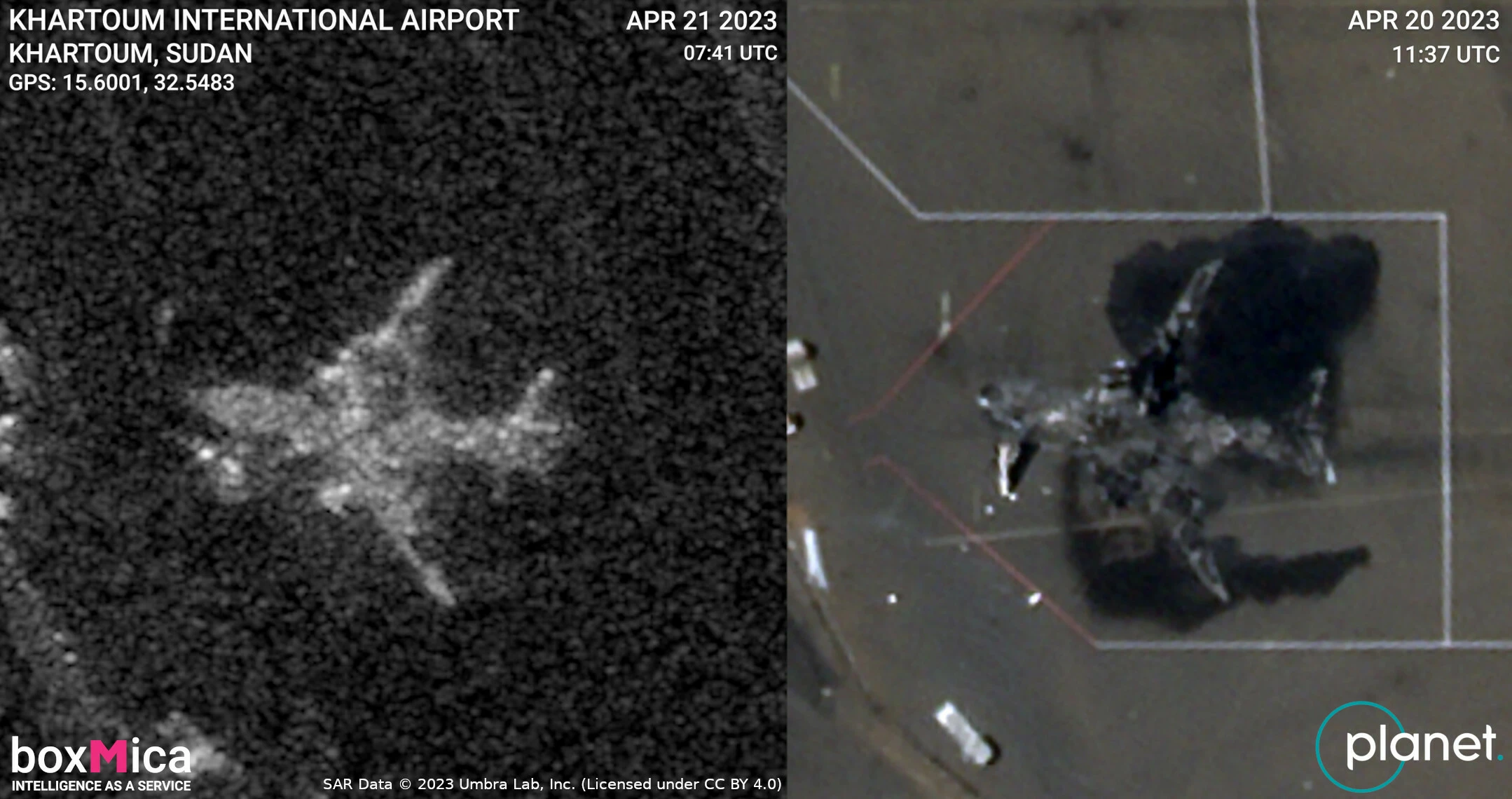
When we began annotating this data, we had never seen a burned-to-the-ground aircraft or truck-trailers. By the time we were done bounding-boxing the assets, our team could easily differentiate burned-down vs normal objects using SAR data alone. Imagine how easy it will be for an AI!
This was only possible with our access to Planet Explorer, quick access to clipped & combined data at checkout, and the high resolution imagery from SkySat.
Optical Imagery GIF:(was too big for upload, great high res gif!)
SUDAN CONFLICT INTL AIRPORT SKYSAT DATA GIF NOV 2022 TO APR 2023
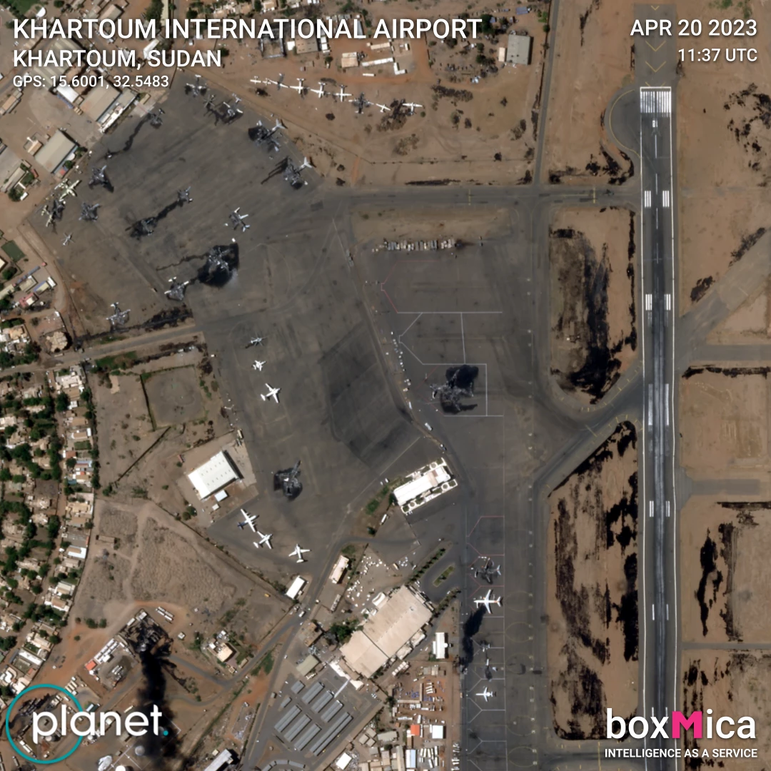
SAR & Optical Imagery, with & without annotations:

Side by side of Umbra SAR & Planet SkySat data of a burned down aircraft:
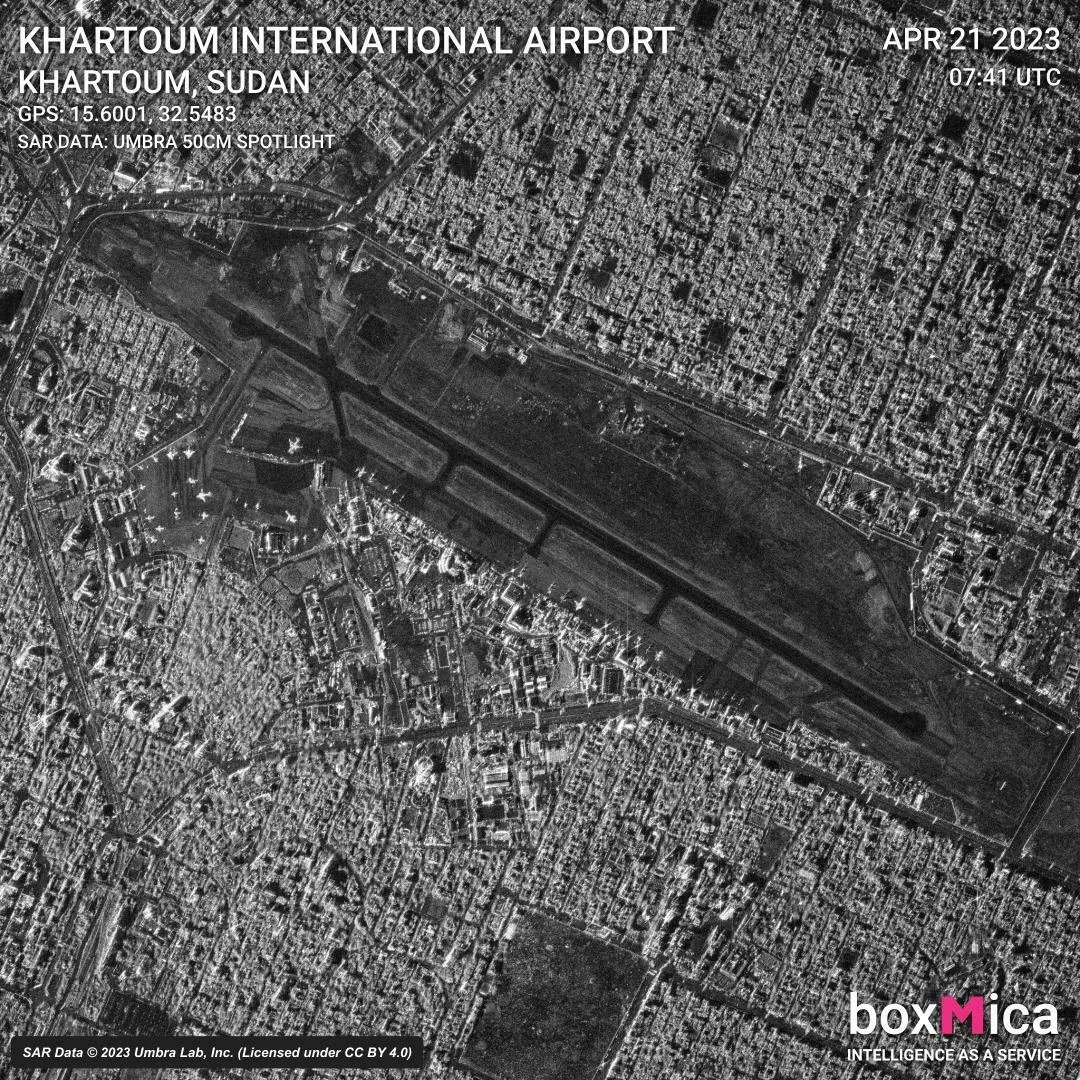
GEC SAR Imagery from Umbra:
Thank you for taking the time to check out our content! I cant wait to see how everyone is using Planet Data!
For more info on Me/boxMica:
boxMica Twitter(lots of fun pics there!): https://twitter.com/boxMica
Add me on LinkedIn: https://www.linkedin.com/in/derekmtishler/
Follow boxMica on Linked: https://www.linkedin.com/company/boxmica/
boxMica Site: https://boxmica.com/
