
Show surroundings and a line of a interest area

  • April 26, 2024
  • 3 replies
  • 304 views

Hello,

I’m trying to get a result as the following image:
image

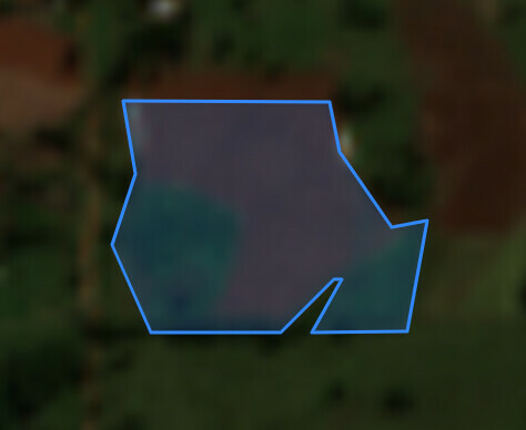
Show the surroundings of an interest area and a line delimiting the polygon.
So far I’m generating the bigger image and the polygon with a transparent mask separately, but it’s lacking the line drawing.

Is there an easier way to get this result?

I tried to find a thread with this, but no luck so far.

Thank you!

3 replies

No. The API accepts the geometry as an input, but does not plot it onto the image itself.

If you can use python, then perhaps have a look at rasterio.


Thanks for your quick response @batic.

My backend is in PHP and I’m using the Process API with evalscript
https://services.sentinel-hub.com/api/v1/process

Can I get the same result with this API?


The answer really depends on the tools you are using.

Using eo-learn you can see some examples for achieving this in the examples, e.g. Measuring the water level of a Theewaterskloof Dam in South Africa — eo-learn 0.9.1 documentation

If you are using QGIS, you could use the Sentinel-Hub plugin to define your satellite imagery, and have your vectors as another layer on top.

Hope that helps.