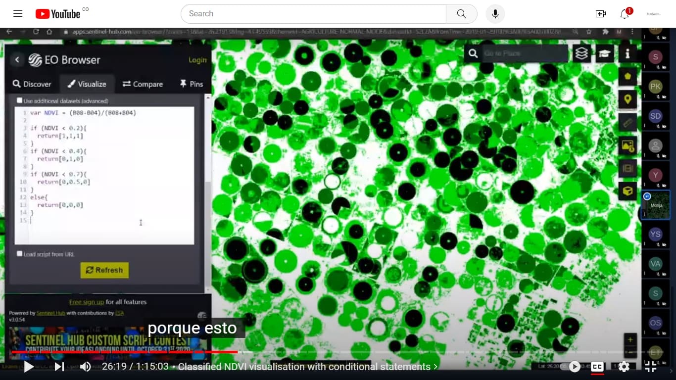
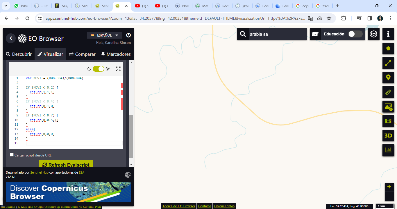
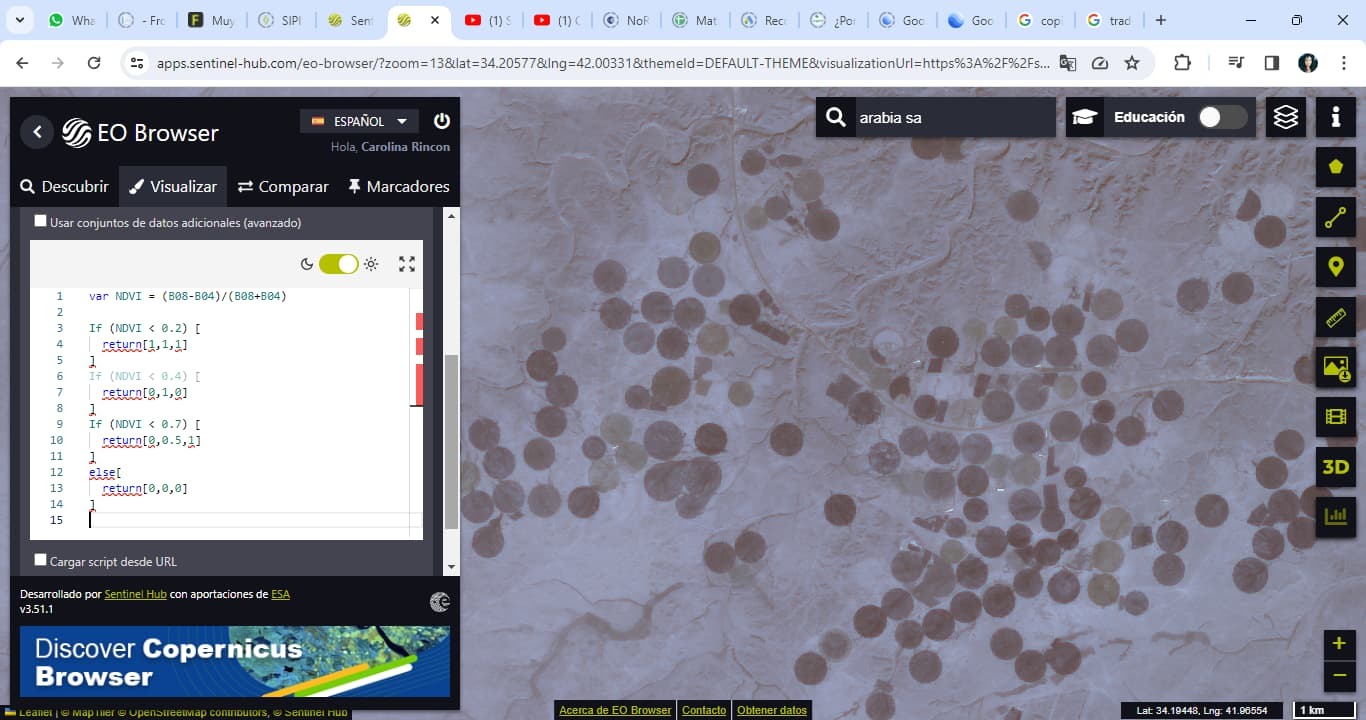
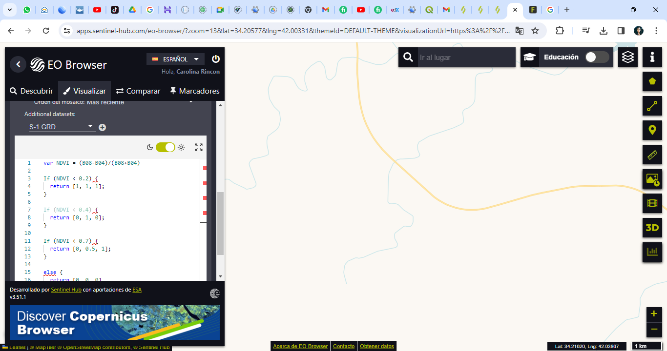
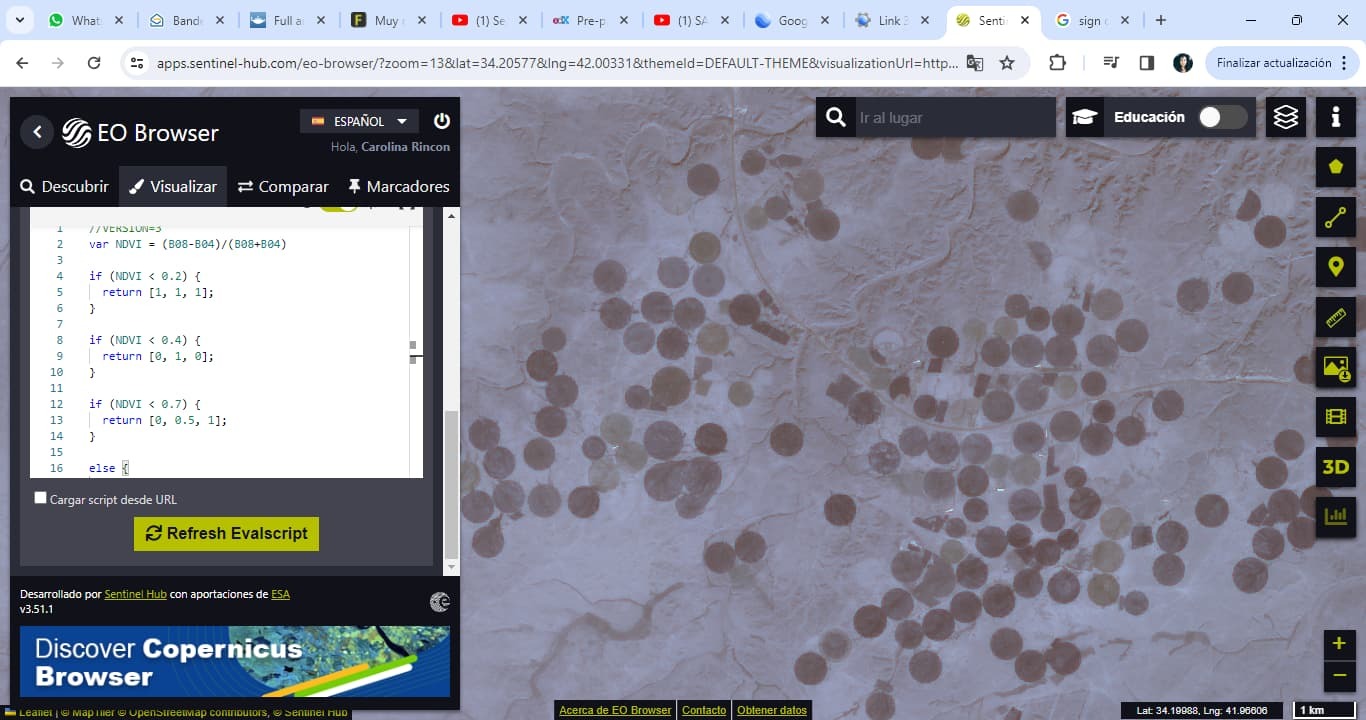
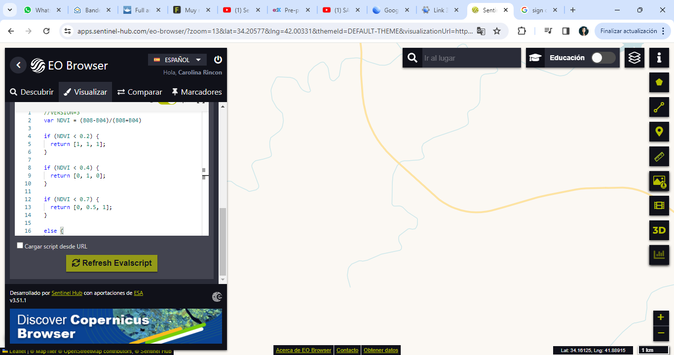
step by step to determine the NDWI and SIPI indices
- Home
- Community overview
- Develop
- Analysis APIs
- Muy nueva en este tema, ayuda!
Muy nueva en este tema, ayuda!
- April 26, 2024
- 25 replies
- 174 views
25 replies
- April 26, 2024
I suggest you check this webinar:
then check:
Sentinel Hub custom scripts
NDWI Normalized Difference Water Index
A repository of custom scripts that can be used with Sentinel-Hub services.
and
Sentinel Hub custom scripts
SIPI (Structure Insensitive Pigment Index)
A repository of custom scripts that can be used with Sentinel-Hub services.
- Author
- April 26, 2024
Hola, comienzo seimpre a seleccionar centinela 2, busqueda avanzada y baja nubosidad y luego buscar y la siguiente pantalla queda en blanco. Qué pasa?
- April 26, 2024
Hi,
It could be the area you’re looking at is a cloudy area and there’s no acquisition having a could coverage lower than the Max. cloud coverage threshold set in your request. Please increase the Max. cloud coverage threshold and try again.
If the issue persists, please provide more info about the steps to reproduce the issue so we can pin down the issue. Thank you!
- Author
- April 26, 2024
Gracias. Pero he tratado de hacer el proceso en diferentes lugares y diferentes dispositivos, y al cargar, todo se ve en blanco?
- April 26, 2024
Hi,
Could you please provide the request returning blank image in Curl format? Alternatively, please provide detailed information about your request, i.e., bounding box, coordinate reference system, time range, collection, output dimension/resolution, image format, and Evalscript.
- Author
- April 26, 2024
Gracias.
Cambie de navegador y ahora no sale la información en blanco. Sale ahora producto no econtrado.
El lugar que busco se llama finaca la martina tenjo, específicamente: Lat: 4,8649682
Lng:-74,1624986
Gracias
- April 26, 2024
Hi,
Are you using EO Browser? Which data collection are you looking for? I tried to search the Sentinel-2 L2A data over your area of interest and there were plenty of data on EO Browser.
As I mentioned, please provide steps to reproduce your issue so we can pin down the issue.
- Author
- April 26, 2024
Are you using EO Browser? Which data collection are you looking for? I tried to search the Sentinel-2 L2A data over your area of interest and there were plenty of data on EO Browser.
As I mentioned, please provide steps to reproduce your issue so we can pin down the issue.
En el navegador de google, abro en mi gmail el correo que me envió sentinel, donde me dan el link para acceder al EO Browser: Sentinel Hub EO Browser. Alli tengo abierta mi sesión. Allí busco la finca Martina Tenjo, escojo sentinel 2, activo busqueda avanzada y bajo el cloud coverage y le doy buscar. Posteriormente abre una nueva página en blanco. En el caso de Mozilla, dice producto no encontrado. Situación que no ocurre en google earth, donde ya encontre la finca y pude dibujar un polígono allí.
- April 26, 2024
Hi,
Did you check out the link I provided? It links to the area you provided and you can find plenty of Sentinel-2 data.
- Author
- April 26, 2024
Good day. I already get images, but they really come out very blurry and checking if it was my internet, it really isn’t. Obviously when we apply RGB, everything looks pixelated. I attach a video link:
drive.google.comSentinel Hub EO Browser - Google Chrome 2023-12-13 21-41-30.mp4
Google Drive file.
Thanks
- April 26, 2024
Hi,
This is the native of resolution. The Red (B04), Green (B03), and Blue (B02) bands of Sentinel-2 have a resolution of 10 m. If higher resolution is required, you may need to consider commercial data such as PlanetScope, SkySat, Pleiades, SPOT, or WorldView.
Note that only PlanetScope is the only constellation which has systematically acquired data around the world daily. Other constellations acquire data only if it is tasked. Please check the data availability before purchasing a quota.
- Author
- April 26, 2024
waoo
In the video you sent me you can see a much better resolution. In this case, the methodology I have is to work with sentinel 2, how is it done?
- April 26, 2024
In the video the high resolution images come from Google Earth and it is not using Sentinel-2 images. Also, it only updates once in a while.
If you need high resolution images of your area of interest and time of interest, you can only go with commercial data I mentioned above.
- Author
- April 26, 2024
- April 26, 2024
Hi ,
There’s a bug in your code. You should use the curly brackets ({}) instead of the square brackets ([]) for the conditional statement. Please see the example below.
if (NDVI < 0.2) {
return [0, 1, 0];
}
- Author
- April 26, 2024
- April 26, 2024
Hi,
if should be lower case.
//VERSION=3
var NDVI = (B08-B04)/(B08+B04)
if (NDVI < 0.2) {
return [1, 1, 1];
}
if (NDVI < 0.4) {
return [0, 1, 0];
}
if (NDVI < 0.7) {
return [0, 0.5, 1];
}
else {
return [0, 0, 0]
}
- April 26, 2024
Enter your E-mail address. We'll send you an e-mail with instructions to reset your password.
Scanning file for viruses.
Sorry, we're still checking this file's contents to make sure it's safe to download. Please try again in a few minutes.
OKThis file cannot be downloaded
Sorry, our virus scanner detected that this file isn't safe to download.
OK
©
2025
Planet Labs PBC. All rights reserved.
|
Privacy Policy
|
California Privacy Notice
|
California Do Not Sell
Your Privacy Choices
|
Cookie Notice
|
Terms of Use


