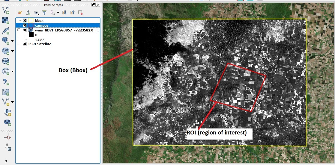
Hello, i wanted to download the NDWI from a ROI in .tiff format. I used the next code, but the outfile shows me values in true color (R, G and B) and not values between -1 and 1. The ROI is a area most little into the bbox.
The next code is in a function
def save_sentinel_patch(height, data_folder):

    bbox = BBox(bbox=[(-7223582,-3839077), (-7142680,-3897777)], crs=CRS.POP_WEB)
    ROI = """MULTIPOLYGON(((-7179178.2313 -3859329.8432,
    -7161416.6336 -3865178.1741,-7168239.6864 -3881965.0500,
    -7187409.2156 -3876658.2312,-7179178.2313 -3859329.8432)))"""

    layer = 'MOISTURE_INDEX'
    wms_bands_request = WmsRequest(data_folder=data_folder,
                                   layer=layer,
                                   bbox=bbox,
                                   time='2017-12-06',
                                   height=height,
                                   #image_format=MimeType.TIFF_d32f,
                                   image_format=MimeType.TIFF_d16,

                                   instance_id=INSTANCE_ID,
                                   custom_url_params={CustomUrlParam.ATMFILTER: 'ATMCOR',
                                                       CustomUrlParam.TRANSPARENT: True,
                                                       CustomUrlParam.GEOMETRY: ROI,
                                                       CustomUrlParam.SHOWLOGO: False})

    wms_img = wms_bands_request.get_data(save_data=True)

    if not wms_img: # Image extraction Failed.
        return False
    else:
        return True            # Image succesfully extracted.

height = 3721
data_folder = '/Example/test_dir'
save_sentinel_patch(height, data_folder)
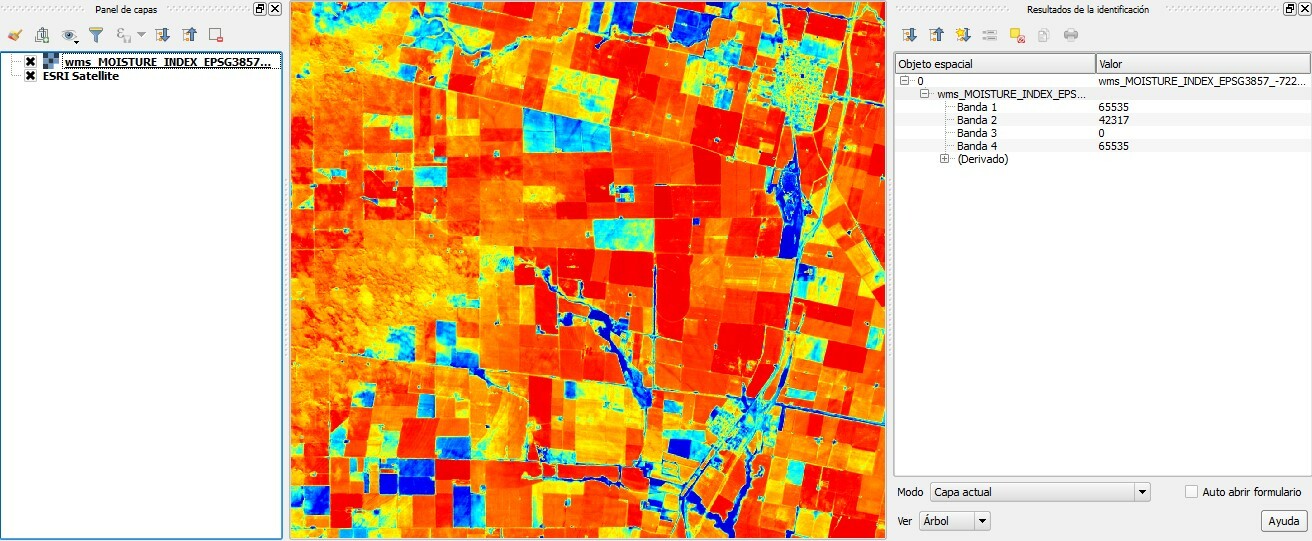
I wonder how can i download the roi in format .tiff with those values?
Thanks